Ringschnait-Ochsenhausen
- 52.3 km
- 350 m
- 347 m
- Laupheim, Baden-Wurttemberg, Germany
A cycling route starting in Laupheim, Baden-Wurttemberg, Germany.
Overview
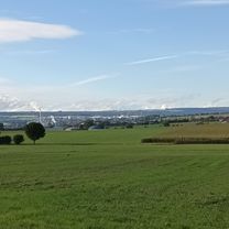
Interesting tour from Laupheim over part of the Alb. Good surfaces, partly subordinate roads, partly asphalted bike paths. Parts of the route are international cycling routes, such as the Danube Bike Trail.
created this 15 years ago
Route quality
Track
32.5 km
39 %
Quiet road
19.2 km
23 %
Paved
50.9 km
(61 %)
Unpaved
12.5 km
(15 %)
Asphalt
48.4 km
58 %
Unpaved (undefined)
4.2 km
5 %
Route highlights
Fahrrad Rommel Fachhändler
Continue with Bikemap
You would like to ride Lph-Ehingen-Schmiechen-Sondernach-Granheim-ErbstettenLauterachEhg.Lph V02 or customize it for your own trip? Here is what you can do with this Bikemap route:
Free trial for 3 days, or one-time payment. More about Bikemap Premium.
Discover more Premium features.
Get Bikemap PremiumFrom our community
Open it in the app