

B2B00624 55104>55125 via Minnehaha Ave, Upper Afton Rd
A cycling route starting in Falcon Heights, Minnesota, United States.
Overview
About this route
0
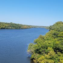
Bike paths run alongside busy roads like Weir Dr and Tamarack Rd.
- -:--
- Duration
- 20 km
- Distance
- 167 m
- Ascent
- 135 m
- Descent
- ---
- Avg. speed
- 313 m
- Max. altitude
nic KEL
created this 17 years ago
Route quality
Waytypes & surfaces along the route
Waytypes
Road
8.6 km
43 %
Quiet road
5.8 km
29 %
Surfaces
Paved
14.4 km
(72 %)
Asphalt
13.2 km
66 %
Concrete
1.2 km
6 %
Undefined
5.6 km
28 %
Continue with Bikemap
Use, edit, or download this cycling route
You would like to ride B2B00624 55104>55125 via Minnehaha Ave, Upper Afton Rd or customize it for your own trip? Here is what you can do with this Bikemap route:
Free features
- Save this route as favorite or in collections
- Copy & plan your own version of this route
- Sync your route with Garmin or Wahoo
Premium features
Free trial for 3 days, or one-time payment. More about Bikemap Premium.
- Navigate this route on iOS & Android
- Export a GPX / KML file of this route
- Create your custom printout (try it for free)
- Download this route for offline navigation
Discover more Premium features.
Get Bikemap PremiumFrom our community
Other popular routes starting in Falcon Heights


Open it in the app