

Scripps Poway to interstate bike path
A cycling route starting in Poway, California, United States.
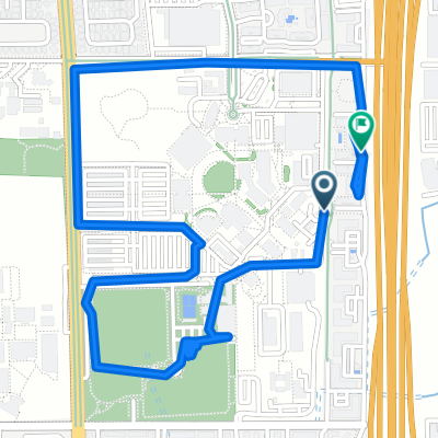
Overview
About this route
- 29 min
- Duration
- 9.8 km
- Distance
- 142 m
- Ascent
- 145 m
- Descent
- 20.2 km/h
- Avg. speed
- ---
- Max. altitude
Route quality
Waytypes & surfaces along the route
Waytypes
Cycleway
2.5 km
(25 %)
Quiet road
1.4 km
(14 %)
Surfaces
Paved
7.8 km
(79 %)
Asphalt
7.8 km
(79 %)
Undefined
2.1 km
(21 %)
Continue with Bikemap
Use, edit, or download this cycling route
You would like to ride Scripps Poway to interstate bike path or customize it for your own trip? Here is what you can do with this Bikemap route:
Free features
- Save this route as favorite or in collections
- Copy & plan your own version of this route
- Sync your route with Garmin or Wahoo
Premium features
Free trial for 3 days, or one-time payment. More about Bikemap Premium.
- Navigate this route on iOS & Android
- Export a GPX / KML file of this route
- Create your custom printout (try it for free)
- Download this route for offline navigation
Discover more Premium features.
Get Bikemap PremiumFrom our community
Other popular routes starting in Poway
 Relaxed route
- Distance
- 15 km
- Ascent
- 241 m
- Descent
- 247 m
- Location
- Poway, California, United States
 Around Poway
- Distance
- 41.7 km
- Ascent
- 439 m
- Descent
- 439 m
- Location
- Poway, California, United States
 Hillery Drive to Hillery Drive
- Distance
- 33.9 km
- Ascent
- 358 m
- Descent
- 331 m
- Location
- Poway, California, United States
 Pow Poway
- Distance
- 82.3 km
- Ascent
- 876 m
- Descent
- 876 m
- Location
- Poway, California, United States
 Restful route
- Distance
- 5.8 km
- Ascent
- 93 m
- Descent
- 60 m
- Location
- Poway, California, United States
 Attempt Up Mt Woodson ~1.7 mi. From Top
- Distance
- 12.2 km
- Ascent
- 431 m
- Descent
- 68 m
- Location
- Poway, California, United States
 Poblado Road 10978, San Diego to Del Dios Hwy. & Bing Crosby Bl., Rancho Santa Fe
- Distance
- 11.3 km
- Ascent
- 188 m
- Descent
- 283 m
- Location
- Poway, California, United States
 Whitewater Dr, Poway to Mesquite Tree Trail, Poway
- Distance
- 9.5 km
- Ascent
- 227 m
- Descent
- 152 m
- Location
- Poway, California, United States
Open it in the app