

Balze Del Valdarno
A cycling route starting in Pian di Scò, Tuscany, Italy.
Overview
About this route
Partenza da Ostina, passaggio da Vaggio per poi tornare ad Ostina compiendo un anello. Il Percorso in generale è facile, ma l'ho categorizzato come medio in quanto negli ultimi 2 chilometri si effettua il passaggio in un punto paludoso con molti alberi caduti nel mezzo e qualche grosso rovo. Per il resto è molto semplice. Si possono ammirare le bellissime balze (nebbia permettendo) e paesaggi molto carini. ATTENZIONE: difficoltà di transito e parcheggio le ultime domeniche dei mesi pari, per apparizione della Madonna
- -:--
- Duration
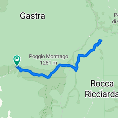
- 10.3 km
- Distance
- 231 m
- Ascent
- 230 m
- Descent
- ---
- Avg. speed
- ---
- Max. altitude

Continue with Bikemap
Use, edit, or download this cycling route
You would like to ride Balze Del Valdarno or customize it for your own trip? Here is what you can do with this Bikemap route:
Free features
- Save this route as favorite or in collections
- Copy & plan your own version of this route
- Sync your route with Garmin or Wahoo
Premium features
Free trial for 3 days, or one-time payment. More about Bikemap Premium.
- Navigate this route on iOS & Android
- Export a GPX / KML file of this route
- Create your custom printout (try it for free)
- Download this route for offline navigation
Discover more Premium features.
Get Bikemap PremiumFrom our community
Other popular routes starting in Pian di Scò
 montrago
- Distance
- 8.5 km
- Ascent
- 663 m
- Descent
- 662 m
- Location
- Pian di Scò, Tuscany, Italy
 giro della zoccola
- Distance
- 56.4 km
- Ascent
- 497 m
- Descent
- 491 m
- Location
- Pian di Scò, Tuscany, Italy
 Balze Del Valdarno
- Distance
- 10.3 km
- Ascent
- 231 m
- Descent
- 230 m
- Location
- Pian di Scò, Tuscany, Italy
 Pian di Sco - Pratomagno
- Distance
- 75.6 km
- Ascent
- 1,548 m
- Descent
- 1,548 m
- Location
- Pian di Scò, Tuscany, Italy
 randonnè 200 km
- Distance
- 202.7 km
- Ascent
- 5,393 m
- Descent
- 5,420 m
- Location
- Pian di Scò, Tuscany, Italy
 piandisco
- Distance
- 1.4 km
- Ascent
- 0 m
- Descent
- 112 m
- Location
- Pian di Scò, Tuscany, Italy
 primo tratto randomauri
- Distance
- 129.4 km
- Ascent
- 1,670 m
- Descent
- 1,676 m
- Location
- Pian di Scò, Tuscany, Italy
 randonnèe degli arditi 300 km CLONED FROM ROUTE 454521
- Distance
- 291.9 km
- Ascent
- 3,385 m
- Descent
- 3,385 m
- Location
- Pian di Scò, Tuscany, Italy
Open it in the app