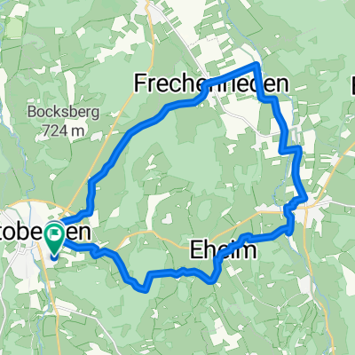
lockere Runde Ottobeuren - Frechenrieden
A cycling route starting in Ottobeuren, Bavaria, Germany.
Overview
About this route
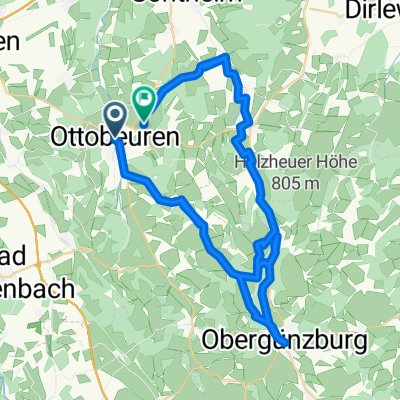
The route is flat, ideal for rolling or pushing the pace, all paved, little traffic, on the Günztal bike path it's busy depending on the time of day.
The Günztal bike path is not yet shown on the map here, but it runs along the old railway line.
- -:--
- Duration
- 40.6 km
- Distance
- 209 m
- Ascent
- 209 m
- Descent
- ---
- Avg. speed
- ---
- Max. altitude
Route quality
Waytypes & surfaces along the route
Waytypes
Quiet road
16.6 km
(41 %)
Path
13.4 km
(33 %)
Surfaces
Paved
27.6 km
(68 %)
Unpaved
1.2 km
(3 %)
Asphalt
19.1 km
(47 %)
Paved (undefined)
8.5 km
(21 %)
Route highlights
Points of interest along the route
Point of interest after 40.6 km
Gabelsbergerstr. Start - Ende
Continue with Bikemap
Use, edit, or download this cycling route
You would like to ride lockere Runde Ottobeuren - Frechenrieden or customize it for your own trip? Here is what you can do with this Bikemap route:
Free features
- Save this route as favorite or in collections
- Copy & plan your own version of this route
- Sync your route with Garmin or Wahoo
Premium features
Free trial for 3 days, or one-time payment. More about Bikemap Premium.
- Navigate this route on iOS & Android
- Export a GPX / KML file of this route
- Create your custom printout (try it for free)
- Download this route for offline navigation
Discover more Premium features.
Get Bikemap PremiumFrom our community
Other popular routes starting in Ottobeuren
Unterallgäuer Natur-Tour- Distance
- 22.5 km
- Ascent
- 200 m
- Descent
- 200 m
- Location
- Ottobeuren, Bavaria, Germany
Ottobeuren West- Distance
- 40.5 km
- Ascent
- 420 m
- Descent
- 395 m
- Location
- Ottobeuren, Bavaria, Germany
UH-Biesenhofen-einfach- Distance
- 40.8 km
- Ascent
- 258 m
- Descent
- 291 m
- Location
- Ottobeuren, Bavaria, Germany
B/D Ottobeuren - Westerheim- Distance
- 8.4 km
- Ascent
- 106 m
- Descent
- 142 m
- Location
- Ottobeuren, Bavaria, Germany
Markt Rettenbach, Tretanlage- Distance
- 23.2 km
- Ascent
- 320 m
- Descent
- 321 m
- Location
- Ottobeuren, Bavaria, Germany
droga z Ottobeuren do Markdorf- Distance
- 99.5 km
- Ascent
- 1,023 m
- Descent
- 1,182 m
- Location
- Ottobeuren, Bavaria, Germany
D03 Allgäu-Runde- Distance
- 438.1 km
- Ascent
- 4,639 m
- Descent
- 4,641 m
- Location
- Ottobeuren, Bavaria, Germany
Ottobeuren Süd- Distance
- 49.1 km
- Ascent
- 812 m
- Descent
- 811 m
- Location
- Ottobeuren, Bavaria, Germany
Open it in the app

