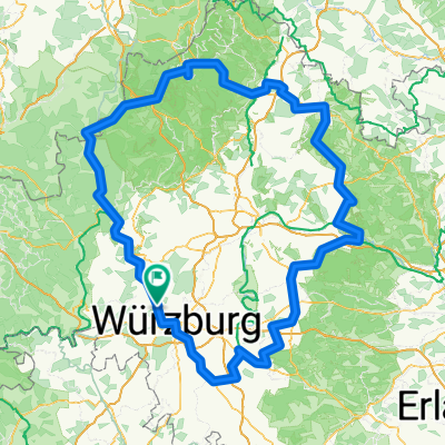
Berg voraus
A cycling route starting in Margetshöchheim, Bavaria, Germany.
Overview
About this route
<p>The route runs mainly along paved dirt roads and on lightly to moderately trafficked country roads.</p>
<p>The start of the tour is at the swimming lake in Erlabrunn. There are usually enough parking spaces available.</p>
Translated, show original (German)- -:--
- Duration
- 38.7 km
- Distance
- 565 m
- Ascent
- 563 m
- Descent
- ---
- Avg. speed
- 333 m
- Max. altitude
Route quality
Waytypes & surfaces along the route
Waytypes
Quiet road
13.5 km
(35 %)
Road
5 km
(13 %)
Surfaces
Paved
30.2 km
(78 %)
Unpaved
1.2 km
(3 %)
Asphalt
27.1 km
(70 %)
Paved (undefined)
3.1 km
(8 %)
Continue with Bikemap
Use, edit, or download this cycling route
You would like to ride Berg voraus or customize it for your own trip? Here is what you can do with this Bikemap route:
Free features
- Save this route as favorite or in collections
- Copy & plan your own version of this route
- Sync your route with Garmin or Wahoo
Premium features
Free trial for 3 days, or one-time payment. More about Bikemap Premium.
- Navigate this route on iOS & Android
- Export a GPX / KML file of this route
- Create your custom printout (try it for free)
- Download this route for offline navigation
Discover more Premium features.
Get Bikemap PremiumFrom our community
Other popular routes starting in Margetshöchheim
- 2021-4
- Distance
- 84.2 km
- Ascent
- 222 m
- Descent
- 219 m
- Location
- Margetshöchheim, Bavaria, Germany
- 2015 Kreuzberg-Tour
- Distance
- 336 km
- Ascent
- 1,258 m
- Descent
- 1,258 m
- Location
- Margetshöchheim, Bavaria, Germany
- Veitshöchheim, Laudenbach hin u. zurück
- Distance
- 35.9 km
- Ascent
- 64 m
- Descent
- 67 m
- Location
- Margetshöchheim, Bavaria, Germany
- M-Weg-Veitshöchheim
- Distance
- 4.8 km
- Ascent
- 268 m
- Descent
- 94 m
- Location
- Margetshöchheim, Bavaria, Germany
- Tour 2015
- Distance
- 326 km
- Ascent
- 1,084 m
- Descent
- 1,074 m
- Location
- Margetshöchheim, Bavaria, Germany
- Würzburg - Gemünden: Main Wander Weg - M-Weg
- Distance
- 69.9 km
- Ascent
- 1,032 m
- Descent
- 1,031 m
- Location
- Margetshöchheim, Bavaria, Germany
- Margetshöchheim Main 92km
- Distance
- 92.4 km
- Ascent
- 385 m
- Descent
- 383 m
- Location
- Margetshöchheim, Bavaria, Germany
- Mainwanderweg MTB
- Distance
- 63 km
- Ascent
- 563 m
- Descent
- 561 m
- Location
- Margetshöchheim, Bavaria, Germany
Open it in the app