

Nantes - Mont Saint Michel
A cycling route starting in Nantes, Pays de la Loire Region, France.
Overview
About this route
Via Vélodyssée - Route 2 Brittany - other
- -:--
- Duration
- 271.4 km
- Distance
- 235 m
- Ascent
- 246 m
- Descent
- ---
- Avg. speed
- ---
- Max. altitude

Route quality
Waytypes & surfaces along the route
Waytypes
Path
65.1 km
(24 %)
Quiet road
62.4 km
(23 %)
Surfaces
Paved
78.7 km
(29 %)
Unpaved
97.7 km
(36 %)
Asphalt
76 km
(28 %)
Gravel
70.6 km
(26 %)
Continue with Bikemap
Use, edit, or download this cycling route
You would like to ride Nantes - Mont Saint Michel or customize it for your own trip? Here is what you can do with this Bikemap route:
Free features
- Save this route as favorite or in collections
- Copy & plan your own version of this route
- Split it into stages to create a multi-day tour
- Sync your route with Garmin or Wahoo
Premium features
Free trial for 3 days, or one-time payment. More about Bikemap Premium.
- Navigate this route on iOS & Android
- Export a GPX / KML file of this route
- Create your custom printout (try it for free)
- Download this route for offline navigation
Discover more Premium features.
Get Bikemap PremiumFrom our community
Other popular routes starting in Nantes
 SE48-190
- Distance
- 48.8 km
- Ascent
- 181 m
- Descent
- 181 m
- Location
- Nantes, Pays de la Loire Region, France
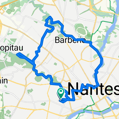
 Boulevard Victor Hugo, Nantes à Boulevard Victor Hugo, Nantes
- Distance
- 24.2 km
- Ascent
- 75 m
- Descent
- 83 m
- Location
- Nantes, Pays de la Loire Region, France
 Les palourdes
- Distance
- 65.5 km
- Ascent
- 263 m
- Descent
- 260 m
- Location
- Nantes, Pays de la Loire Region, France
 N-Peloton Ride #90
- Distance
- 38.6 km
- Ascent
- 97 m
- Descent
- 99 m
- Location
- Nantes, Pays de la Loire Region, France
 Nantes/ St florent / Nantes
- Distance
- 108.7 km
- Ascent
- 246 m
- Descent
- 251 m
- Location
- Nantes, Pays de la Loire Region, France
 Y35 Day 1
- Distance
- 56.3 km
- Ascent
- 812 m
- Descent
- 817 m
- Location
- Nantes, Pays de la Loire Region, France
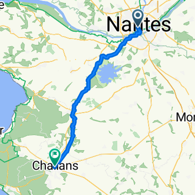 Von Nantes bis Challans
- Distance
- 61.3 km
- Ascent
- 180 m
- Descent
- 186 m
- Location
- Nantes, Pays de la Loire Region, France
 De Rue Colette Magny à Rue Colette Magny
- Distance
- 20.7 km
- Ascent
- 154 m
- Descent
- 156 m
- Location
- Nantes, Pays de la Loire Region, France
Open it in the app