
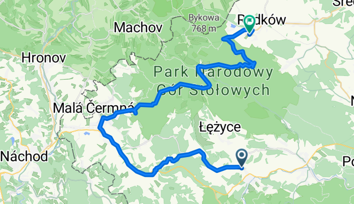
51_Duszniki - Radkow, 40km
A cycling route starting in Duszniki-Zdrój, Lower Silesian Voivodeship, Poland.
Overview
About this route
Słoszów - Kulin - Leśna - Lewin Klodz - Kudowa - road of 100 curves - Kräłów - Radków
- -:--
- Duration
- 36.4 km
- Distance
- 685 m
- Ascent
- 856 m
- Descent
- ---
- Avg. speed
- ---
- Max. altitude

Route quality
Waytypes & surfaces along the route
Waytypes
Road
5.5 km
(15 %)
Quiet road
3.6 km
(10 %)
Surfaces
Paved
32.4 km
(89 %)
Unpaved
1.5 km
(4 %)
Asphalt
32.4 km
(89 %)
Unpaved (undefined)
1.1 km
(3 %)
Continue with Bikemap
Use, edit, or download this cycling route
You would like to ride 51_Duszniki - Radkow, 40km or customize it for your own trip? Here is what you can do with this Bikemap route:
Free features
- Save this route as favorite or in collections
- Copy & plan your own version of this route
- Sync your route with Garmin or Wahoo
Premium features
Free trial for 3 days, or one-time payment. More about Bikemap Premium.
- Navigate this route on iOS & Android
- Export a GPX / KML file of this route
- Create your custom printout (try it for free)
- Download this route for offline navigation
Discover more Premium features.
Get Bikemap PremiumFrom our community
Other popular routes starting in Duszniki-Zdrój
 d8_40km_Duszniki - Kudowa - Rakow
- Distance
- 38.1 km
- Ascent
- 585 m
- Descent
- 756 m
- Location
- Duszniki-Zdrój, Lower Silesian Voivodeship, Poland
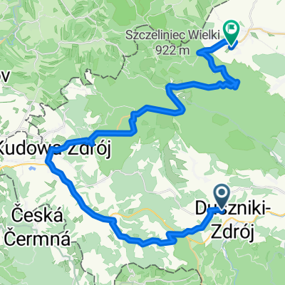
 🇵🇱 🇨🇿 ORLICA '18 - Olrica
- Distance
- 11.7 km
- Ascent
- 378 m
- Descent
- 379 m
- Location
- Duszniki-Zdrój, Lower Silesian Voivodeship, Poland
 18.07 VI etapp Duzniki Zdroj - Usti nad Orlici
- Distance
- 79.8 km
- Ascent
- 917 m
- Descent
- 1,138 m
- Location
- Duszniki-Zdrój, Lower Silesian Voivodeship, Poland
 Zieleniecke torfowiska :)
- Distance
- 38.6 km
- Ascent
- 542 m
- Descent
- 542 m
- Location
- Duszniki-Zdrój, Lower Silesian Voivodeship, Poland
 51_Duszniki - Radkow, 40km
- Distance
- 36.4 km
- Ascent
- 685 m
- Descent
- 856 m
- Location
- Duszniki-Zdrój, Lower Silesian Voivodeship, Poland
 Kłodzka, Duszniki-Zdrój do Sudecka, Duszniki-Zdrój
- Distance
- 70.4 km
- Ascent
- 1,640 m
- Descent
- 1,627 m
- Location
- Duszniki-Zdrój, Lower Silesian Voivodeship, Poland
 Trasa A | Dookoła Gór Stołowych
- Distance
- 50 km
- Ascent
- 684 m
- Descent
- 686 m
- Location
- Duszniki-Zdrój, Lower Silesian Voivodeship, Poland
 Tour de Korona Polski 2020 dzień 12
- Distance
- 101 km
- Ascent
- 1,262 m
- Descent
- 1,233 m
- Location
- Duszniki-Zdrój, Lower Silesian Voivodeship, Poland
Open it in the app