

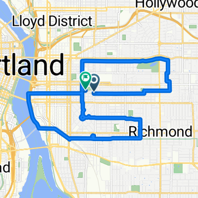
50mi loop to troutdale
A cycling route starting in Portland, Oregon, United States.
Overview
About this route
Top half is fun. Bottom half could use some better roads. I just wanted to gtf home.
- -:--
- Duration
- 75.9 km
- Distance
- 278 m
- Ascent
- 274 m
- Descent
- ---
- Avg. speed
- ---
- Max. altitude

Route quality
Waytypes & surfaces along the route
Waytypes
Quiet road
20.5 km
(27 %)
Cycleway
9.9 km
(13 %)
Surfaces
Paved
39.5 km
(52 %)
Asphalt
28.8 km
(38 %)
Paved (undefined)
10.6 km
(14 %)
Undefined
36.4 km
(48 %)
Route highlights
Points of interest along the route
Point of interest after 1 km
start
Continue with Bikemap
Use, edit, or download this cycling route
You would like to ride 50mi loop to troutdale or customize it for your own trip? Here is what you can do with this Bikemap route:
Free features
- Save this route as favorite or in collections
- Copy & plan your own version of this route
- Sync your route with Garmin or Wahoo
Premium features
Free trial for 3 days, or one-time payment. More about Bikemap Premium.
- Navigate this route on iOS & Android
- Export a GPX / KML file of this route
- Create your custom printout (try it for free)
- Download this route for offline navigation
Discover more Premium features.
Get Bikemap PremiumFrom our community
Other popular routes starting in Portland
 50mi loop to troutdale
- Distance
- 75.9 km
- Ascent
- 278 m
- Descent
- 274 m
- Location
- Portland, Oregon, United States
 Distance Training
- Distance
- 46.7 km
- Ascent
- 186 m
- Descent
- 218 m
- Location
- Portland, Oregon, United States
 8/2017 Century Plus Route 1
- Distance
- 177.9 km
- Ascent
- 995 m
- Descent
- 993 m
- Location
- Portland, Oregon, United States
 A Coffee + Architecture + Platting + Infrastructure + Beer Exploration
- Distance
- 9.9 km
- Ascent
- 122 m
- Descent
- 121 m
- Location
- Portland, Oregon, United States
 I-5 to 205 Loop
- Distance
- 38.7 km
- Ascent
- 178 m
- Descent
- 180 m
- Location
- Portland, Oregon, United States
 august: a taylor swift ride v1
- Distance
- 15.4 km
- Ascent
- 98 m
- Descent
- 103 m
- Location
- Portland, Oregon, United States
 Portland to Casc Locks OR via I 84
- Distance
- 71.7 km
- Ascent
- 318 m
- Descent
- 316 m
- Location
- Portland, Oregon, United States
 Modified Sellwood bridge route
- Distance
- 18.5 km
- Ascent
- 211 m
- Descent
- 212 m
- Location
- Portland, Oregon, United States
Open it in the app