kleine Familienrunde zum Heurigen
A cycling route starting in Göpfritz an der Wild, Lower Austria, Austria.
Overview
About this route
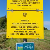
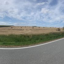
From Göpfritz over mostly forest paths towards Dietmannsdorf. Just after the forest, it goes back to the quarry. Upon reaching the road, it goes over Rothweinsdorf, Nonndorf, Haselberg to the Heurigen at Reichharts. From there, along the road to Oed and back into the woods towards the quarry. In Oedt, there is an option to go towards Blumau and first turn into the forest there. A few more kilometers in the beautiful Wild cycling and you are already back in Göpfritz. The roads are very lightly trafficked.
- -:--
- Duration
- 26.5 km
- Distance
- 211 m
- Ascent
- 199 m
- Descent
- ---
- Avg. speed
- 614 m
- Max. altitude
Route quality
Waytypes & surfaces along the route
Waytypes
Track
13.8 km
(52 %)
Road
6.9 km
(26 %)
Surfaces
Paved
7.4 km
(28 %)
Unpaved
9.5 km
(36 %)
Asphalt
6.9 km
(26 %)
Gravel
6.6 km
(25 %)
Route highlights
Points of interest along the route
Point of interest after 6.9 km
Steinbruch
Point of interest after 14.2 km
Heuriger
Continue with Bikemap
Use, edit, or download this cycling route
You would like to ride kleine Familienrunde zum Heurigen or customize it for your own trip? Here is what you can do with this Bikemap route:
Free features
- Save this route as favorite or in collections
- Copy & plan your own version of this route
- Sync your route with Garmin or Wahoo
Premium features
Free trial for 3 days, or one-time payment. More about Bikemap Premium.
- Navigate this route on iOS & Android
- Export a GPX / KML file of this route
- Create your custom printout (try it for free)
- Download this route for offline navigation
Discover more Premium features.
Get Bikemap PremiumFrom our community
Other popular routes starting in Göpfritz an der Wild
 Knödelland-Radweg ab Göpfritz an der Wild
- Distance
- 43.3 km
- Ascent
- 457 m
- Descent
- 506 m
- Location
- Göpfritz an der Wild, Lower Austria, Austria
 durch den Tüpl
- Distance
- 47 km
- Ascent
- 454 m
- Descent
- 454 m
- Location
- Göpfritz an der Wild, Lower Austria, Austria
 Waldviertel: Knödel-Land-Radweg
- Distance
- 55.2 km
- Ascent
- 432 m
- Descent
- 432 m
- Location
- Göpfritz an der Wild, Lower Austria, Austria
 KnödelLand Radweg
- Distance
- 43.5 km
- Ascent
- 431 m
- Descent
- 433 m
- Location
- Göpfritz an der Wild, Lower Austria, Austria
 Slavonice Tag 1
- Distance
- 52.1 km
- Ascent
- 480 m
- Descent
- 544 m
- Location
- Göpfritz an der Wild, Lower Austria, Austria
 48.735, 15.384 nach 48.998, 15.356
- Distance
- 55 km
- Ascent
- 563 m
- Descent
- 620 m
- Location
- Göpfritz an der Wild, Lower Austria, Austria
 kleine Familienrunde zum Heurigen
- Distance
- 26.5 km
- Ascent
- 211 m
- Descent
- 199 m
- Location
- Göpfritz an der Wild, Lower Austria, Austria
 göpfritz - raabs - karlstein - dobersberg - waidhofen - göpfritz
- Distance
- 72.1 km
- Ascent
- 457 m
- Descent
- 457 m
- Location
- Göpfritz an der Wild, Lower Austria, Austria
Open it in the app


