

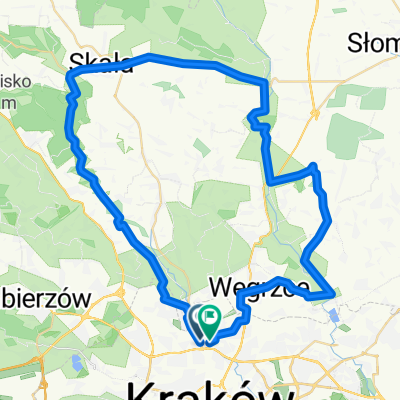
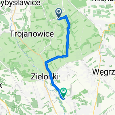
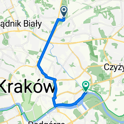
Szlak czerwony w gminie zielonki
A cycling route starting in Zielonki, Lesser Poland Voivodeship, Poland.
Overview
About this route
The red trail in the municipality of Zielonki
- -:--
- Duration
- 32.6 km
- Distance
- 345 m
- Ascent
- 345 m
- Descent
- ---
- Avg. speed
- ---
- Max. altitude

Route highlights
Points of interest along the route
Point of interest after 2.1 km
Dawna prochownia
Point of interest after 6.7 km
Fort 44a Pękowice
Point of interest after 6.9 km
Fort 44 Tonie (Syberia)
Point of interest after 10.1 km
Punkt widokowy
Point of interest after 13.8 km
Zamek w Korzkwi
Point of interest after 18.3 km
Punkt Widokowy
Point of interest after 20.4 km
Zespół Sworski w Owczarach
Point of interest after 21.2 km
Punkt Widokowy
Point of interest after 26 km
Zespół Dworski
Point of interest after 26.9 km
Punkt Widokowy
Point of interest after 27.8 km
Fort 45 Zielonki
Point of interest after 28.1 km
Punkt Widokowy
Point of interest after 29.6 km
Fort 45a Bibice
Point of interest after 31.9 km
Fort 47a Węgrzce
Point of interest after 32.1 km
Fort 47 Łysa Góra
Continue with Bikemap
Use, edit, or download this cycling route
You would like to ride Szlak czerwony w gminie zielonki or customize it for your own trip? Here is what you can do with this Bikemap route:
Free features
- Save this route as favorite or in collections
- Copy & plan your own version of this route
- Sync your route with Garmin or Wahoo
Premium features
Free trial for 3 days, or one-time payment. More about Bikemap Premium.
- Navigate this route on iOS & Android
- Export a GPX / KML file of this route
- Create your custom printout (try it for free)
- Download this route for offline navigation
Discover more Premium features.
Get Bikemap PremiumFrom our community
Other popular routes starting in Zielonki
 Treningo-wycieczka MTB na Pustynię Błędowską
- Distance
- 114.7 km
- Ascent
- 783 m
- Descent
- 783 m
- Location
- Zielonki, Lesser Poland Voivodeship, Poland
 Bibice - Zielonki
- Distance
- 2.8 km
- Ascent
- 38 m
- Descent
- 31 m
- Location
- Zielonki, Lesser Poland Voivodeship, Poland
 Dolina Dłubni
- Distance
- 59.3 km
- Ascent
- 826 m
- Descent
- 830 m
- Location
- Zielonki, Lesser Poland Voivodeship, Poland
 Wola Zachariaszowska- Witkowice
- Distance
- 7 km
- Ascent
- 31 m
- Descent
- 107 m
- Location
- Zielonki, Lesser Poland Voivodeship, Poland
 Route to Krakow
- Distance
- 8.9 km
- Ascent
- 8 m
- Descent
- 39 m
- Location
- Zielonki, Lesser Poland Voivodeship, Poland
 Dolina Prądnika
- Distance
- 44.4 km
- Ascent
- 421 m
- Descent
- 421 m
- Location
- Zielonki, Lesser Poland Voivodeship, Poland
 Zimowo super zamrożone.
- Distance
- 54 km
- Ascent
- 489 m
- Descent
- 487 m
- Location
- Zielonki, Lesser Poland Voivodeship, Poland
 pętelka treningowa
- Distance
- 47.6 km
- Ascent
- 634 m
- Descent
- 636 m
- Location
- Zielonki, Lesser Poland Voivodeship, Poland
Open it in the app