

Throcking Cottered
A cycling route starting in Baldock, England, United Kingdom.
Overview
About this route
All routes OS map verified Bridleways, Byways, and Restricted Byways - Legal for bikes. *Past A505 underpass, there is a non-OS map track going right before the Railway underpass. It goes between the railway and the A505. (Ordnance Survey maps required: 193 - Luton & Stevenage; and 194 - Hertford & Bishop Stortford).
- -:--
- Duration
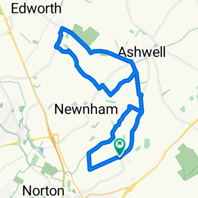
- 47.1 km
- Distance
- 323 m
- Ascent
- 323 m
- Descent
- ---
- Avg. speed
- ---
- Max. altitude

Route photos


Route quality
Waytypes & surfaces along the route
Waytypes
Track
16.5 km
(35 %)
Quiet road
11.8 km
(25 %)
Surfaces
Paved
4.2 km
(9 %)
Unpaved
5.2 km
(11 %)
Paved (undefined)
2.8 km
(6 %)
Unpaved (undefined)
1.9 km
(4 %)
Continue with Bikemap
Use, edit, or download this cycling route
You would like to ride Throcking Cottered or customize it for your own trip? Here is what you can do with this Bikemap route:
Free features
- Save this route as favorite or in collections
- Copy & plan your own version of this route
- Sync your route with Garmin or Wahoo
Premium features
Free trial for 3 days, or one-time payment. More about Bikemap Premium.
- Navigate this route on iOS & Android
- Export a GPX / KML file of this route
- Create your custom printout (try it for free)
- Download this route for offline navigation
Discover more Premium features.
Get Bikemap PremiumFrom our community
Other popular routes starting in Baldock
 Throcking Cottered
- Distance
- 47.1 km
- Ascent
- 323 m
- Descent
- 323 m
- Location
- Baldock, England, United Kingdom
 Cross-Potter
- Distance
- 52.3 km
- Ascent
- 159 m
- Descent
- 161 m
- Location
- Baldock, England, United Kingdom
 Hinxworth Castanet
- Distance
- 18.8 km
- Ascent
- 180 m
- Descent
- 180 m
- Location
- Baldock, England, United Kingdom
 Lost Railroad
- Distance
- 72.8 km
- Ascent
- 429 m
- Descent
- 429 m
- Location
- Baldock, England, United Kingdom
 Wiggy
Wiggy- Distance
- 48.3 km
- Ascent
- 334 m
- Descent
- 334 m
- Location
- Baldock, England, United Kingdom
 Thunder Ridge
- Distance
- 76.9 km
- Ascent
- 402 m
- Descent
- 401 m
- Location
- Baldock, England, United Kingdom
 Mighty Meander
- Distance
- 173.8 km
- Ascent
- 460 m
- Descent
- 460 m
- Location
- Baldock, England, United Kingdom
 Hatley Wood Spaghetti
- Distance
- 64.8 km
- Ascent
- 242 m
- Descent
- 244 m
- Location
- Baldock, England, United Kingdom
Open it in the app