Stunt Piuma loop
A cycling route starting in Agoura, California, United States of America.
Overview
About this route
- -:--
- Duration
- 61.2 km
- Distance
- 1,002 m
- Ascent
- 999 m
- Descent
- ---
- Avg. speed
- ---
- Avg. speed
Route quality
Waytypes & surfaces along the route
Waytypes
Road
33.5 km
(55 %)
Busy road
20.3 km
(33 %)
Surfaces
Paved
28.9 km
(47 %)
Asphalt
28.9 km
(47 %)
Concrete
0 km
(<1 %)
Undefined
32.3 km
(53 %)
Continue with Bikemap
Use, edit, or download this cycling route
You would like to ride Stunt Piuma loop or customize it for your own trip? Here is what you can do with this Bikemap route:
Free features
- Save this route as favorite or in collections
- Copy & plan your own version of this route
- Sync your route with Garmin or Wahoo
Premium features
Free trial for 3 days, or one-time payment. More about Bikemap Premium.
- Navigate this route on iOS & Android
- Export a GPX / KML file of this route
- Create your custom printout (try it for free)
- Download this route for offline navigation
Discover more Premium features.
Get Bikemap PremiumFrom our community
Other popular routes starting in Agoura
- Stunt Piuma loop
- Distance
- 61.2 km
- Ascent
- 1,002 m
- Descent
- 999 m
- Location
- Agoura, California, United States of America
- Cheseboro Canyon
- Distance
- 14.9 km
- Ascent
- 243 m
- Descent
- 244 m
- Location
- Agoura, California, United States of America
- Westlake Loop Route 30 mile ride
- Distance
- 52.2 km
- Ascent
- 672 m
- Descent
- 671 m
- Location
- Agoura, California, United States of America
- Conejo View Drive 28860, Agoura Hills to Conejo View Drive 28860, Agoura Hills
- Distance
- 23.8 km
- Ascent
- 444 m
- Descent
- 443 m
- Location
- Agoura, California, United States of America
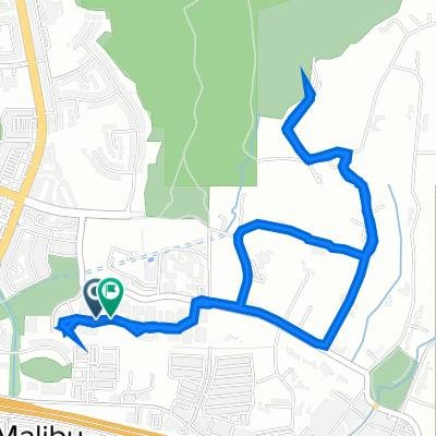
- agoura to hidden hills
- Distance
- 9.3 km
- Ascent
- 240 m
- Descent
- 209 m
- Location
- Agoura, California, United States of America
- Santa Suzana Mtn's loop
- Distance
- 89.1 km
- Ascent
- 777 m
- Descent
- 777 m
- Location
- Agoura, California, United States of America
- Chesbro longer ride
- Distance
- 24.2 km
- Ascent
- 527 m
- Descent
- 527 m
- Location
- Agoura, California, United States of America
- To Albertson's motorway and gas pipe
- Distance
- 28.9 km
- Ascent
- 663 m
- Descent
- 663 m
- Location
- Agoura, California, United States of America