

Le Puy Mary (1783m) et la vallée du Falgoux par les crêtes
A cycling route starting in Riom-ès-Montagnes, Auvergne-Rhône-Alpes, France.
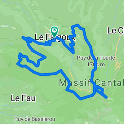
Overview
About this route
I set my mind on crossing all the cols of Auvergne with my bike. / On paper, the program is promising: 8 cols including 5 mule tracks making a tour of the Falgoux valley, with the highest point being the Puy Mary (1783m)! / A dream route on foot, less fun with a bike! / I have 2 gaps to cross and the approach to the Enfloquet gap worries me a bit...
- 13 h 13 min
- Duration
- 43.9 km
- Distance
- 1,933 m
- Ascent
- 1,934 m
- Descent
- 3.3 km/h
- Avg. speed
- ---
- Max. altitude

Continue with Bikemap
Use, edit, or download this cycling route
You would like to ride Le Puy Mary (1783m) et la vallée du Falgoux par les crêtes or customize it for your own trip? Here is what you can do with this Bikemap route:
Free features
- Save this route as favorite or in collections
- Copy & plan your own version of this route
- Sync your route with Garmin or Wahoo
Premium features
Free trial for 3 days, or one-time payment. More about Bikemap Premium.
- Navigate this route on iOS & Android
- Export a GPX / KML file of this route
- Create your custom printout (try it for free)
- Download this route for offline navigation
Discover more Premium features.
Get Bikemap PremiumFrom our community
Other popular routes starting in Riom-ès-Montagnes
 12. Etappe: Condat über Pas de Peyrol
- Distance
- 52.6 km
- Ascent
- 1,064 m
- Descent
- 1,154 m
- Location
- Riom-ès-Montagnes, Auvergne-Rhône-Alpes, France
 4.etapa Riom-es-Montagnes - Saint-Cirgues-De-Jordanne
- Distance
- 84.3 km
- Ascent
- 1,474 m
- Descent
- 1,454 m
- Location
- Riom-ès-Montagnes, Auvergne-Rhône-Alpes, France
 Cantal 2022 circuit N°1 - 43km samedi aprem
- Distance
- 43.2 km
- Ascent
- 951 m
- Descent
- 954 m
- Location
- Riom-ès-Montagnes, Auvergne-Rhône-Alpes, France
 Le Falgoux-Le Lioran
- Distance
- 28 km
- Ascent
- 1,164 m
- Descent
- 820 m
- Location
- Riom-ès-Montagnes, Auvergne-Rhône-Alpes, France
 Cantal 2022 N°2 80km 1580D+
- Distance
- 80.1 km
- Ascent
- 1,648 m
- Descent
- 1,646 m
- Location
- Riom-ès-Montagnes, Auvergne-Rhône-Alpes, France
 Cantal 2022 N°XL157km 3400D+
- Distance
- 156.9 km
- Ascent
- 3,928 m
- Descent
- 3,928 m
- Location
- Riom-ès-Montagnes, Auvergne-Rhône-Alpes, France
 Le Puy Mary (1783m) et la vallée du Falgoux par les crêtes
- Distance
- 43.9 km
- Ascent
- 1,933 m
- Descent
- 1,934 m
- Location
- Riom-ès-Montagnes, Auvergne-Rhône-Alpes, France
 Cantal 2022 N°1 bis 61km
- Distance
- 60.9 km
- Ascent
- 1,396 m
- Descent
- 1,397 m
- Location
- Riom-ès-Montagnes, Auvergne-Rhône-Alpes, France
Open it in the app