
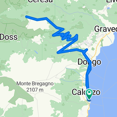
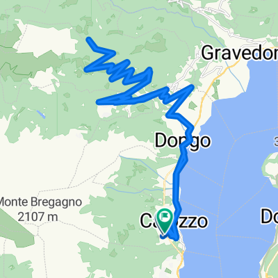
Gravedona nach Bodone
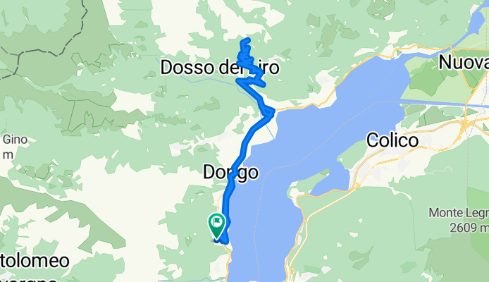
A cycling route starting in Calozzo, Lombardy, Italy.
Overview
About this route
Die Strecke empfängt einen mit ein paar kurzen, aber saftigen Rampen mit bis zu 19%, beruhigt sich aber nach den ersten drei Kilometern etwas, was auch die Buckelpiste zu Beginn vergessen lässt. Die perfekt ausgebaute Straße schlängelt sich hinauf bis Peglio und entlässt einen dann hinter einer Kirche links herum in den endlosen Anstieg mit durchschnittlich 8%. Leider glänzt dieser nicht gerade mit feinem Asphalt, was besonders mit dem Rennrad die Abfahrt zum waghalsigen Abenteuer macht. Im Gegensatz zu vielen anderen Anstiegen in der Gegend endet die Strecke nicht an einem Schotterweg, sondern an einem Aussichtpunkt mit Quelle und tollem Ausblick auf das Nordende des Sees.
- -:--
- Duration
- 37 km
- Distance
- 1,297 m
- Ascent
- 1,353 m
- Descent
- ---
- Avg. speed
- 1,175 m
- Avg. speed

Route quality
Waytypes & surfaces along the route
Waytypes
Quiet road
19.8 km
(54 %)
Road
8.2 km
(22 %)
Surfaces
Paved
27.6 km
(75 %)
Asphalt
18.6 km
(50 %)
Paved (undefined)
9 km
(24 %)
Undefined
9.4 km
(25 %)
Continue with Bikemap
Use, edit, or download this cycling route
You would like to ride Gravedona nach Bodone or customize it for your own trip? Here is what you can do with this Bikemap route:
Free features
- Save this route as favorite or in collections
- Copy & plan your own version of this route
- Sync your route with Garmin or Wahoo
Premium features
Free trial for 3 days, or one-time payment. More about Bikemap Premium.
- Navigate this route on iOS & Android
- Export a GPX / KML file of this route
- Create your custom printout (try it for free)
- Download this route for offline navigation
Discover more Premium features.
Get Bikemap PremiumFrom our community
Other popular routes starting in Calozzo
 Alpe Giumalle
- Distance
- 184.2 km
- Ascent
- 2,013 m
- Descent
- 2,009 m
- Location
- Calozzo, Lombardy, Italy
 Refugio Mottafoiada
- Distance
- 44.1 km
- Ascent
- 1,233 m
- Descent
- 1,238 m
- Location
- Calozzo, Lombardy, Italy
 Saliana_Pianello del Lario_Passo Spluga
- Distance
- 144.5 km
- Ascent
- 2,218 m
- Descent
- 2,218 m
- Location
- Calozzo, Lombardy, Italy
 Hoch über Garzeno und zurück
- Distance
- 39.7 km
- Ascent
- 1,648 m
- Descent
- 1,530 m
- Location
- Calozzo, Lombardy, Italy
 Von Garzeno durch den Zauberwald
- Distance
- 30.1 km
- Ascent
- 912 m
- Descent
- 912 m
- Location
- Calozzo, Lombardy, Italy
 kleiner Urlaubsblödsinn
- Distance
- 141.5 km
- Ascent
- 2,947 m
- Descent
- 2,671 m
- Location
- Calozzo, Lombardy, Italy
 Da Frazione Calozzo 12, Pianello del Lario a Via Tempietto 4, Tremezzina
- Distance
- 15.8 km
- Ascent
- 373 m
- Descent
- 366 m
- Location
- Calozzo, Lombardy, Italy
 Intelvi
- Distance
- 70.6 km
- Ascent
- 921 m
- Descent
- 915 m
- Location
- Calozzo, Lombardy, Italy
Open it in the app