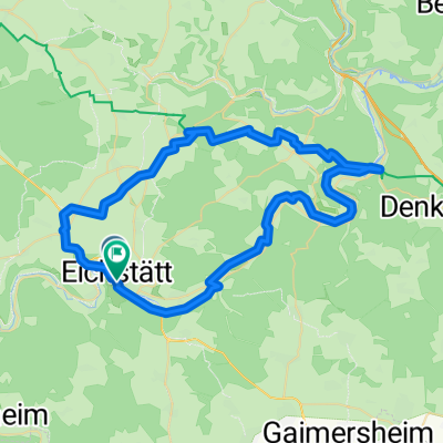
Altmühltal 4
A cycling route starting in Eichstätt, Bavaria, Germany.
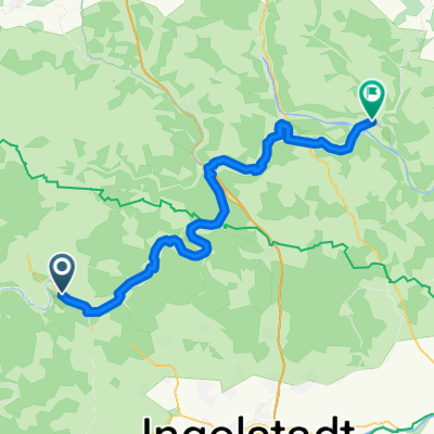
Overview
About this route
- -:--
- Duration
- 59 km
- Distance
- 312 m
- Ascent
- 311 m
- Descent
- ---
- Avg. speed
- ---
- Avg. speed
Route quality
Waytypes & surfaces along the route
Waytypes
Track
16.6 km
(28 %)
Busy road
11.4 km
(19 %)
Surfaces
Paved
50.9 km
(86 %)
Unpaved
4.8 km
(8 %)
Asphalt
50.2 km
(85 %)
Gravel
2.9 km
(5 %)
Continue with Bikemap
Use, edit, or download this cycling route
You would like to ride Altmühltal 4 or customize it for your own trip? Here is what you can do with this Bikemap route:
Free features
- Save this route as favorite or in collections
- Copy & plan your own version of this route
- Sync your route with Garmin or Wahoo
Premium features
Free trial for 3 days, or one-time payment. More about Bikemap Premium.
- Navigate this route on iOS & Android
- Export a GPX / KML file of this route
- Create your custom printout (try it for free)
- Download this route for offline navigation
Discover more Premium features.
Get Bikemap PremiumFrom our community
Other popular routes starting in Eichstätt
- Eichstätt Cycling
- Distance
- 52 km
- Ascent
- 398 m
- Descent
- 399 m
- Location
- Eichstätt, Bavaria, Germany
- Dom zu Eichstätt über Ingolstadt bis Wallheim und zurück
- Distance
- 100.1 km
- Ascent
- 347 m
- Descent
- 347 m
- Location
- Eichstätt, Bavaria, Germany
- RT 2016, 1. Etappe; Eichstätt - Pappenheim
- Distance
- 32.9 km
- Ascent
- 221 m
- Descent
- 258 m
- Location
- Eichstätt, Bavaria, Germany
- Wellheim reverse
- Distance
- 41.3 km
- Ascent
- 253 m
- Descent
- 311 m
- Location
- Eichstätt, Bavaria, Germany
- Wasserzell-Dollnstein und zurück
- Distance
- 23.8 km
- Ascent
- 416 m
- Descent
- 337 m
- Location
- Eichstätt, Bavaria, Germany
- RadTour 6: Geotoptour
- Distance
- 80.7 km
- Ascent
- 556 m
- Descent
- 555 m
- Location
- Eichstätt, Bavaria, Germany
- 3. Dienstag: Eichstätt-Denkendorf
- Distance
- 34.1 km
- Ascent
- 278 m
- Descent
- 178 m
- Location
- Eichstätt, Bavaria, Germany
- Wasserzell-Dollnstein-Aicha und zurück CLONED FROM ROUTE 238504
- Distance
- 32.2 km
- Ascent
- 529 m
- Descent
- 526 m
- Location
- Eichstätt, Bavaria, Germany
Open it in the app