Saint Paul Saturday Stroll
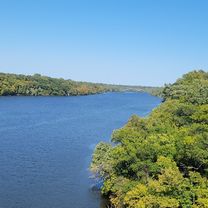
A cycling route starting in Falcon Heights, Minnesota, United States of America.
Overview
About this route
- 2 h 39 min
- Duration
- 32.4 km
- Distance
- 197 m
- Ascent
- 198 m
- Descent
- 12.2 km/h
- Avg. speed
- ---
- Avg. speed
Route photos
Route quality
Waytypes & surfaces along the route
Waytypes
Cycleway
12.2 km
(38 %)
Road
9.6 km
(30 %)
Surfaces
Paved
20.7 km
(64 %)
Asphalt
17.6 km
(54 %)
Paved (undefined)
1.6 km
(5 %)
Continue with Bikemap
Use, edit, or download this cycling route
You would like to ride Saint Paul Saturday Stroll or customize it for your own trip? Here is what you can do with this Bikemap route:
Free features
- Save this route as favorite or in collections
- Copy & plan your own version of this route
- Sync your route with Garmin or Wahoo
Premium features
Free trial for 3 days, or one-time payment. More about Bikemap Premium.
- Navigate this route on iOS & Android
- Export a GPX / KML file of this route
- Create your custom printout (try it for free)
- Download this route for offline navigation
Discover more Premium features.
Get Bikemap PremiumFrom our community
Other popular routes starting in Falcon Heights
- B2B00444 55104>55119 via Minnehaha Ave W, Case Ave, Reaney Ave
- Distance
- 18.3 km
- Ascent
- 111 m
- Descent
- 94 m
- Location
- Falcon Heights, Minnesota, United States of America
- 2019 Saint Paul Classic (long)
- Distance
- 49 km
- Ascent
- 178 m
- Descent
- 180 m
- Location
- Falcon Heights, Minnesota, United States of America
- St. Paul Classic short loop
- Distance
- 22.8 km
- Ascent
- 200 m
- Descent
- 184 m
- Location
- Falcon Heights, Minnesota, United States of America
- St Paul Classic 2014 Route
- Distance
- 49.3 km
- Ascent
- 233 m
- Descent
- 236 m
- Location
- Falcon Heights, Minnesota, United States of America
- B2B00017 - 55104 to 55402
- Distance
- 12.2 km
- Ascent
- 125 m
- Descent
- 155 m
- Location
- Falcon Heights, Minnesota, United States of America
- Saint Paul Saturday Stroll
- Distance
- 32.4 km
- Ascent
- 197 m
- Descent
- 198 m
- Location
- Falcon Heights, Minnesota, United States of America
- LOLOL
- Distance
- 57.5 km
- Ascent
- 187 m
- Descent
- 187 m
- Location
- Falcon Heights, Minnesota, United States of America
- B2B00773 55104>55418 via Pelham Blvd, Transitway, Mpls Diag Trl, St Anthony Pkwy
- Distance
- 17.2 km
- Ascent
- 72 m
- Descent
- 81 m
- Location
- Falcon Heights, Minnesota, United States of America