

Unterschächen - Klausenpass - Lichtenstein
A cycling route starting in Bürglen, Canton of Uri, Switzerland.
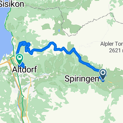
Overview
About this route
- 9 h 3 min
- Duration
- 123.8 km
- Distance
- 3,613 m
- Ascent
- 4,109 m
- Descent
- 13.7 km/h
- Avg. speed
- ---
- Max. altitude

Route quality
Waytypes & surfaces along the route
Waytypes
Quiet road
28.5 km
(23 %)
Track
19.8 km
(16 %)
Surfaces
Paved
105.2 km
(85 %)
Unpaved
8.7 km
(7 %)
Asphalt
104 km
(84 %)
Loose gravel
5 km
(4 %)
Continue with Bikemap
Use, edit, or download this cycling route
You would like to ride Unterschächen - Klausenpass - Lichtenstein or customize it for your own trip? Here is what you can do with this Bikemap route:
Free features
- Save this route as favorite or in collections
- Copy & plan your own version of this route
- Split it into stages to create a multi-day tour
- Sync your route with Garmin or Wahoo
Premium features
Free trial for 3 days, or one-time payment. More about Bikemap Premium.
- Navigate this route on iOS & Android
- Export a GPX / KML file of this route
- Create your custom printout (try it for free)
- Download this route for offline navigation
Discover more Premium features.
Get Bikemap PremiumFrom our community
Other popular routes starting in Bürglen
 Haldi Lehn Im Wald Verfahren 28.5.
- Distance
- 15.3 km
- Ascent
- 199 m
- Descent
- 1,081 m
- Location
- Bürglen, Canton of Uri, Switzerland
 Zentralschweiz
- Distance
- 152.2 km
- Ascent
- 2,302 m
- Descent
- 2,302 m
- Location
- Bürglen, Canton of Uri, Switzerland
 Unterschächen - Glarus
- Distance
- 51.9 km
- Ascent
- 1,161 m
- Descent
- 1,694 m
- Location
- Bürglen, Canton of Uri, Switzerland
 Burglen Klausenpass Linthal 45 km (Andermatt)
- Distance
- 44.1 km
- Ascent
- 1,374 m
- Descent
- 1,284 m
- Location
- Bürglen, Canton of Uri, Switzerland

Garmin
Bürglen UR Radfahren- Distance
- 129.4 km
- Ascent
- 2,913 m
- Descent
- 2,909 m
- Location
- Bürglen, Canton of Uri, Switzerland
 Brunnital
- Distance
- 29.3 km
- Ascent
- 1,541 m
- Descent
- 1,041 m
- Location
- Bürglen, Canton of Uri, Switzerland
 Klausenpass_Pragelpass_Bisistal_Illgau
- Distance
- 158.2 km
- Ascent
- 4,394 m
- Descent
- 4,531 m
- Location
- Bürglen, Canton of Uri, Switzerland
 Panoramatour Urigen-Biel-Eggbergen-Altdorf
- Distance
- 22.6 km
- Ascent
- 830 m
- Descent
- 1,260 m
- Location
- Bürglen, Canton of Uri, Switzerland
Open it in the app