

Attempt Up Mt Woodson ~1.7 mi. From Top
A cycling route starting in Poway, California, United States.
Overview
About this route
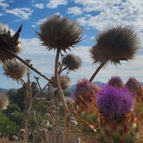
Glenn texted me i had 15 min. b4 the sunset. No choice but to turn around. Sucks cause its a long steep climp. Now to it all again and more...
- -:--
- Duration
- 12.2 km
- Distance
- 431 m
- Ascent
- 68 m
- Descent
- ---
- Avg. speed
- ---
- Max. altitude
Route highlights
Points of interest along the route
Point of interest after 0 km
Continue with Bikemap
Use, edit, or download this cycling route
You would like to ride Attempt Up Mt Woodson ~1.7 mi. From Top or customize it for your own trip? Here is what you can do with this Bikemap route:
Free features
- Save this route as favorite or in collections
- Copy & plan your own version of this route
- Sync your route with Garmin or Wahoo
Premium features
Free trial for 3 days, or one-time payment. More about Bikemap Premium.
- Navigate this route on iOS & Android
- Export a GPX / KML file of this route
- Create your custom printout (try it for free)
- Download this route for offline navigation
Discover more Premium features.
Get Bikemap PremiumFrom our community
Other popular routes starting in Poway
 Vueltecita
- Distance
- 50.9 km
- Ascent
- 647 m
- Descent
- 647 m
- Location
- Poway, California, United States
 Oak Knoll Road 12223, Poway to Oak Knoll Road 12223, Poway
- Distance
- 15.4 km
- Ascent
- 219 m
- Descent
- 220 m
- Location
- Poway, California, United States
 looks easy
- Distance
- 13.1 km
- Ascent
- 139 m
- Descent
- 136 m
- Location
- Poway, California, United States
 Attempt Up Mt Woodson ~1.7 mi. From Top
- Distance
- 12.2 km
- Ascent
- 431 m
- Descent
- 68 m
- Location
- Poway, California, United States
 Creekview - around Blue Sky Canyon
- Distance
- 52.6 km
- Ascent
- 626 m
- Descent
- 626 m
- Location
- Poway, California, United States
 Pow Poway
- Distance
- 82.3 km
- Ascent
- 876 m
- Descent
- 876 m
- Location
- Poway, California, United States
 13538 Sabre Springs Pkwy, San Diego to 11622 El Camino Real, San Diego
- Distance
- 17.5 km
- Ascent
- 180 m
- Descent
- 328 m
- Location
- Poway, California, United States
 Around Poway
- Distance
- 41.7 km
- Ascent
- 439 m
- Descent
- 439 m
- Location
- Poway, California, United States
Open it in the app