

Nürburgring (Grüne Hölle)
A cycling route starting in Adenau, Rhineland-Palatinate, Germany.
Overview
About this route
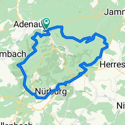
Kurzbeschreibung: rund um den Nürburgring (Nordschleife). Weg ist gut ausgeschildert.
Auflistung der Orte: Adenau, Meuspath, Nürburg
Track Beschreibung: In Andernach der Beschilderung (siehe Fotos) folgen. Die Strecke führt steil auf die Hohe Acht, entlang der Nordschleife. Der Weg dorthin ist meist auf Schotter und Geröll. Nicht angenehm zu fahren. Oben angekommen ist ein großer Parkplatz mit eine kleinen Imbissbude (Kaffee war gut :-). Quer über den Parkplatz zur Bundesstraße. Dort etwas unglücklich der Leitplanke entlang (ca. 100m). Ab hier geht's entspannt weiter. Zur Rechten immer die Nordschleife. Folgt immer der Beschilderung. Teilweise ist diese auch etwas versteckt oder auch nicht vorhanden. Aber ihr habt ja GPS ;-) Zwischendurch schöne Abfahrten und kleinere Steigungen. Erst im letzten Drittel der Strecke kommt ein schöner Singletrail durch den Wald.
Track Kommentar: Schön wenn man mal dort war. Aber wirklich empfehlenswert ist die Tour nicht. Für Motorsportfreunde bestimmt interessant da man entlang der Nordschleife viel zu sehen hat. Landschaftlich schön, die Wege leider nicht. Zu viel Asphalt und Geröll.
- -:--
- Duration
- 25.2 km
- Distance
- 620 m
- Ascent
- 617 m
- Descent
- ---
- Avg. speed
- ---
- Max. altitude

Route quality
Waytypes & surfaces along the route
Waytypes
Track
16.6 km
(66 %)
Quiet road
2.5 km
(10 %)
Surfaces
Paved
9.8 km
(39 %)
Unpaved
13.9 km
(55 %)
Ground
10.8 km
(43 %)
Asphalt
8.8 km
(35 %)
Continue with Bikemap
Use, edit, or download this cycling route
You would like to ride Nürburgring (Grüne Hölle) or customize it for your own trip? Here is what you can do with this Bikemap route:
Free features
- Save this route as favorite or in collections
- Copy & plan your own version of this route
- Sync your route with Garmin or Wahoo
Premium features
Free trial for 3 days, or one-time payment. More about Bikemap Premium.
- Navigate this route on iOS & Android
- Export a GPX / KML file of this route
- Create your custom printout (try it for free)
- Download this route for offline navigation
Discover more Premium features.
Get Bikemap PremiumFrom our community
Other popular routes starting in Adenau
 Das Kelberger Land
- Distance
- 52.6 km
- Ascent
- 728 m
- Descent
- 727 m
- Location
- Adenau, Rhineland-Palatinate, Germany
 Hohe Acht Anstieg II
- Distance
- 6.9 km
- Ascent
- 360 m
- Descent
- 8 m
- Location
- Adenau, Rhineland-Palatinate, Germany
 13.04.2013 Nürburgring
- Distance
- 22.8 km
- Ascent
- 493 m
- Descent
- 493 m
- Location
- Adenau, Rhineland-Palatinate, Germany
 Adenau-Stramproy
- Distance
- 179.9 km
- Ascent
- 2,227 m
- Descent
- 2,498 m
- Location
- Adenau, Rhineland-Palatinate, Germany
 Nürburgring (Grüne Hölle)
- Distance
- 25.4 km
- Ascent
- 544 m
- Descent
- 544 m
- Location
- Adenau, Rhineland-Palatinate, Germany
 Breidscheid
- Distance
- 5.3 km
- Ascent
- 358 m
- Descent
- 130 m
- Location
- Adenau, Rhineland-Palatinate, Germany
 Nürburgring und Hohe Acht
- Distance
- 29 km
- Ascent
- 594 m
- Descent
- 603 m
- Location
- Adenau, Rhineland-Palatinate, Germany
 Relaxed Afternoon Track In Adenau
- Distance
- 32.4 km
- Ascent
- 732 m
- Descent
- 716 m
- Location
- Adenau, Rhineland-Palatinate, Germany
Open it in the app