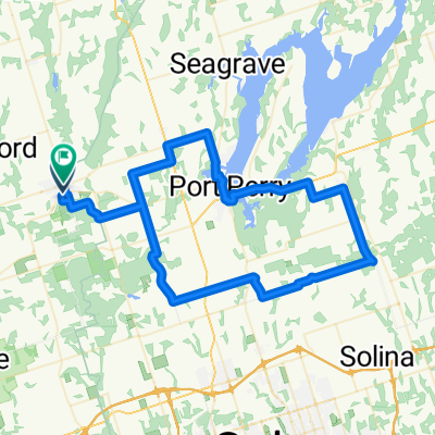
Uxbridge/Lindsey Rail Trail (Aka Trans Canada Trail) Uxbridge to Mariposa Station (Little Britain)
A cycling route starting in Uxbridge, Ontario, Canada.
Overview
About this route
- 6 h 28 min
- Duration
- 70.9 km
- Distance
- 295 m
- Ascent
- 296 m
- Descent
- 11 km/h
- Avg. speed
- ---
- Avg. speed
Route photos
Route quality
Waytypes & surfaces along the route
Waytypes
Path
66.1 km
(93 %)
Pedestrian area
4.5 km
(6 %)
Surfaces
Paved
0.1 km
(<1 %)
Unpaved
33.1 km
(47 %)
Unpaved (undefined)
29.5 km
(42 %)
Ground
2.7 km
(4 %)
Continue with Bikemap
Use, edit, or download this cycling route
You would like to ride Uxbridge/Lindsey Rail Trail (Aka Trans Canada Trail) Uxbridge to Mariposa Station (Little Britain) or customize it for your own trip? Here is what you can do with this Bikemap route:
Free features
- Save this route as favorite or in collections
- Copy & plan your own version of this route
- Sync your route with Garmin or Wahoo
Premium features
Free trial for 3 days, or one-time payment. More about Bikemap Premium.
- Navigate this route on iOS & Android
- Export a GPX / KML file of this route
- Create your custom printout (try it for free)
- Download this route for offline navigation
Discover more Premium features.
Get Bikemap PremiumFrom our community
Other popular routes starting in Uxbridge
- round scugog
- Distance
- 86.1 km
- Ascent
- 267 m
- Descent
- 267 m
- Location
- Uxbridge, Ontario, Canada
- Uxbridge to Peterborough
- Distance
- 92.2 km
- Ascent
- 356 m
- Descent
- 428 m
- Location
- Uxbridge, Ontario, Canada
- round scugog
- Distance
- 86 km
- Ascent
- 244 m
- Descent
- 241 m
- Location
- Uxbridge, Ontario, Canada
- S. Durham
- Distance
- 56.5 km
- Ascent
- 451 m
- Descent
- 448 m
- Location
- Uxbridge, Ontario, Canada
- Uxbridge/Lindsey Rail Trail (Aka Trans Canada Trail) Uxbridge to Mariposa Station (Little Britain)
- Distance
- 70.9 km
- Ascent
- 295 m
- Descent
- 296 m
- Location
- Uxbridge, Ontario, Canada
- Greenbelt Route (GTA East-Port Hope)
- Distance
- 98.7 km
- Ascent
- 809 m
- Descent
- 1,014 m
- Location
- Uxbridge, Ontario, Canada
- Local Loop
- Distance
- 65.2 km
- Ascent
- 417 m
- Descent
- 417 m
- Location
- Uxbridge, Ontario, Canada
- Port Perry to 48 gravel ride
- Distance
- 106.9 km
- Ascent
- 233 m
- Descent
- 232 m
- Location
- Uxbridge, Ontario, Canada
Open it in the app