HRANICA-Cintoríny z prvej svetovej vojny
- 39.7 km
- 601 m
- 601 m
- Medzilaborce, Prešov Region, Slovakia
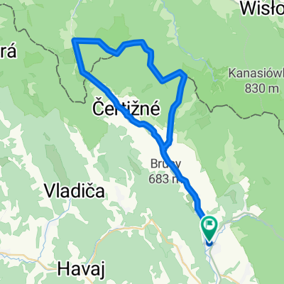
A cycling route starting in Medzilaborce, Prešov Region, Slovakia.
Overview
The route through the World War I cemeteries leads along an asphalt road from ML through Habura to Čertižné, across the border towards Jasliska, about 1.5 km past the border on a forest asphalt road to the right to the end station, and then along the forest path towards the border to the left to Habuda. At the border, there are 7 cemeteries from World War I, nicely maintained with information boards. Along the border to the marker Vodojem and then right down towards Chvastejov - through the field and forest following the hiking signs you will come to the old forest asphalt road, and from there you will get to Habura and ML.
created this 15 years ago
Continue with Bikemap
You would like to ride HRANICA-Cintoríny z prvej svetovej vojny or customize it for your own trip? Here is what you can do with this Bikemap route:
Free trial for 3 days, or one-time payment. More about Bikemap Premium.
Discover more Premium features.
Get Bikemap PremiumFrom our community
Open it in the app