
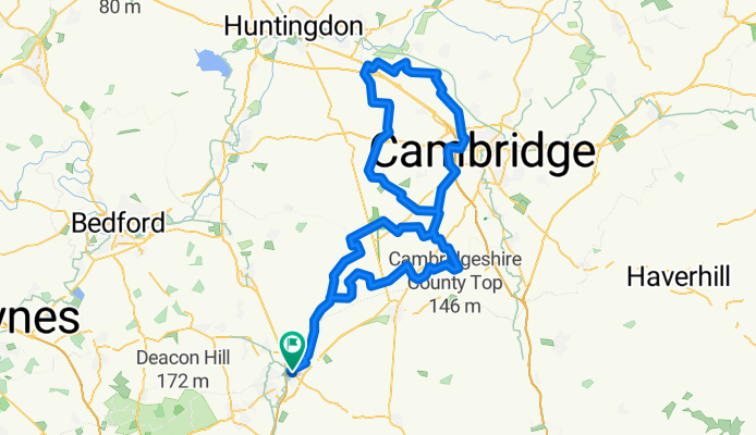
West Cam
A cycling route starting in Baldock, England, United Kingdom.
Overview
About this route
Explore the countryside roads West of Cambridge. One Byway and Bridleway leading to a lane East of Knapwell. But if Byway too muddy, you can just cycle through Knapwell to avoid it and rejoin the route further on.
- -:--
- Duration
- 129.2 km
- Distance
- 246 m
- Ascent
- 246 m
- Descent
- ---
- Avg. speed
- ---
- Max. altitude

Route photos


Route quality
Waytypes & surfaces along the route
Waytypes
Road
95.3 km
(74 %)
Quiet road
14.3 km
(11 %)
Surfaces
Paved
29.6 km
(23 %)
Unpaved
1.3 km
(1 %)
Asphalt
27.3 km
(21 %)
Paved (undefined)
2.1 km
(2 %)
Continue with Bikemap
Use, edit, or download this cycling route
You would like to ride West Cam or customize it for your own trip? Here is what you can do with this Bikemap route:
Free features
- Save this route as favorite or in collections
- Copy & plan your own version of this route
- Split it into stages to create a multi-day tour
- Sync your route with Garmin or Wahoo
Premium features
Free trial for 3 days, or one-time payment. More about Bikemap Premium.
- Navigate this route on iOS & Android
- Export a GPX / KML file of this route
- Create your custom printout (try it for free)
- Download this route for offline navigation
Discover more Premium features.
Get Bikemap PremiumFrom our community
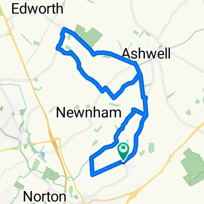
Other popular routes starting in Baldock
 Throcking Cottered
- Distance
- 47.1 km
- Ascent
- 323 m
- Descent
- 323 m
- Location
- Baldock, England, United Kingdom
 Cross-Potter
- Distance
- 52.3 km
- Ascent
- 159 m
- Descent
- 161 m
- Location
- Baldock, England, United Kingdom
 Hinxworth Castanet
- Distance
- 18.8 km
- Ascent
- 180 m
- Descent
- 180 m
- Location
- Baldock, England, United Kingdom
 Halo Reach
- Distance
- 122.5 km
- Ascent
- 158 m
- Descent
- 158 m
- Location
- Baldock, England, United Kingdom
 West Cam
- Distance
- 129.2 km
- Ascent
- 246 m
- Descent
- 246 m
- Location
- Baldock, England, United Kingdom
 Thumbs Up Barton
- Distance
- 53.8 km
- Ascent
- 361 m
- Descent
- 362 m
- Location
- Baldock, England, United Kingdom
 Wiggy
Wiggy- Distance
- 48.3 km
- Ascent
- 334 m
- Descent
- 334 m
- Location
- Baldock, England, United Kingdom
 Thunder Ridge
- Distance
- 76.9 km
- Ascent
- 402 m
- Descent
- 401 m
- Location
- Baldock, England, United Kingdom
Open it in the app