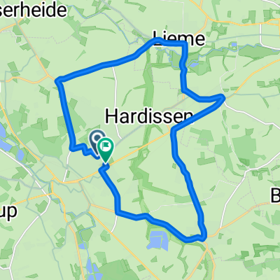
- 35.8 km
- 310 m
- 314 m
- Lage, North Rhine-Westphalia, Germany
Teutoburgerwald Rennradstrecke
A cycling route starting in Lage, North Rhine-Westphalia, Germany.
Overview
About this route
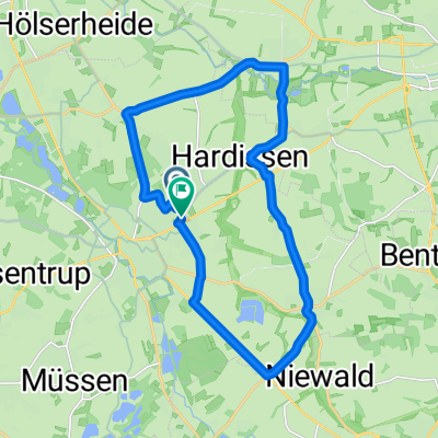
A pure road bike track. Predominantly roads with little vehicle traffic. It also goes over the Monument Road to the Hermann Monument. Good fitness should be already in place.
- -:--
- Duration
- 65.1 km
- Distance
- 584 m
- Ascent
- 617 m
- Descent
- ---
- Avg. speed
- 349 m
- Max. altitude
created this 18 years ago
Route quality
Waytypes & surfaces along the route
Waytypes
Path
15.6 km
(24 %)
Quiet road
13.7 km
(21 %)
Surfaces
Paved
55.4 km
(85 %)
Unpaved
3.3 km
(5 %)
Asphalt
54.7 km
(84 %)
Ground
2 km
(3 %)
Route highlights
Points of interest along the route
Point of interest after 60.5 km
Radfirma Gronemeyer Telefon 05202-4052
Continue with Bikemap
Use, edit, or download this cycling route
You would like to ride Teutoburgerwald Rennradstrecke or customize it for your own trip? Here is what you can do with this Bikemap route:
Free features
- Save this route as favorite or in collections
- Copy & plan your own version of this route
- Sync your route with Garmin or Wahoo
Premium features
Free trial for 3 days, or one-time payment. More about Bikemap Premium.
- Navigate this route on iOS & Android
- Export a GPX / KML file of this route
- Create your custom printout (try it for free)
- Download this route for offline navigation
Discover more Premium features.
Get Bikemap PremiumFrom our community
Other popular routes starting in Lage
- kirchheim1
- Lage Hörste Herrmann bikemap
- 39.3 km
- 646 m
- 529 m
- Lage, North Rhine-Westphalia, Germany
- Traumhafte Frühlingsrunde am 9.3. bei 18 Grad
- 73.9 km
- 781 m
- 781 m
- Lage, North Rhine-Westphalia, Germany
- Freiligrathstraße, Lage nach Freiligrathstraße, Lage
- 17 km
- 115 m
- 114 m
- Lage, North Rhine-Westphalia, Germany
- Freiligrathstraße, Lage nach Freiligrathstraße, Lage
- 24 km
- 155 m
- 155 m
- Lage, North Rhine-Westphalia, Germany
- Freiligrathstraße, Lage nach Freiligrathstraße, Lage
- 18.3 km
- 158 m
- 161 m
- Lage, North Rhine-Westphalia, Germany
- Sonntagmorgen Rundtour zum Skypoint Detmold und zurück.
- 25.8 km
- 114 m
- 113 m
- Lage, North Rhine-Westphalia, Germany
- Teutoburgerwald Rennradstrecke
- 65.1 km
- 584 m
- 617 m
- Lage, North Rhine-Westphalia, Germany
Open it in the app


