24 Rue de Belhomme, Gy-en-Sologne à 29 Rue de Belhomme, Gy-en-Sologne
- 0.9 km
- 182 m
- 180 m
- Pruniers-en-Sologne, Centre-Val de Loire, France
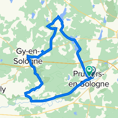
A cycling route starting in Pruniers-en-Sologne, Centre-Val de Loire, France.
Overview
Camping dee Lunery
Address: 4 Rue de l'Abreuvoir, 18400 Lunery, France
Phone: +33 2 48 68 07 38
created this 4 years ago
Route quality
Quiet road
34.8 km
44 %
Road
11.1 km
14 %
Paved
26.1 km
(33 %)
Asphalt
23.7 km
30 %
Concrete
2.4 km
3 %
Undefined
53 km
67 %
Continue with Bikemap
You would like to ride R2 Pruniers - Lunery or customize it for your own trip? Here is what you can do with this Bikemap route:
Free trial for 3 days, or one-time payment. More about Bikemap Premium.
Discover more Premium features.
Get Bikemap PremiumFrom our community
Open it in the app