

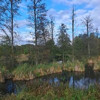
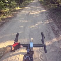
Nieporęt - Warszawa (Kanał Żerański)
A cycling route starting in Nieporęt, Masovian Voivodeship, Poland.
Overview
About this route
- -:--
- Duration
- 42.3 km
- Distance
- 52 m
- Ascent
- 23 m
- Descent
- ---
- Avg. speed
- 114 m
- Max. altitude

Route quality
Waytypes & surfaces along the route
Waytypes
Cycleway
14.4 km
(34 %)
Path
13.5 km
(32 %)
Surfaces
Paved
24.9 km
(59 %)
Unpaved
12.3 km
(29 %)
Asphalt
22 km
(52 %)
Gravel
7.2 km
(17 %)
Continue with Bikemap
Use, edit, or download this cycling route
You would like to ride Nieporęt - Warszawa (Kanał Żerański) or customize it for your own trip? Here is what you can do with this Bikemap route:
Free features
- Save this route as favorite or in collections
- Copy & plan your own version of this route
- Sync your route with Garmin or Wahoo
Premium features
Free trial for 3 days, or one-time payment. More about Bikemap Premium.
- Navigate this route on iOS & Android
- Export a GPX / KML file of this route
- Create your custom printout (try it for free)
- Download this route for offline navigation
Discover more Premium features.
Get Bikemap PremiumFrom our community
Other popular routes starting in Nieporęt
 Zegrzyńska, Nieporęt do Kwiatowa 22, Warszawa
- Distance
- 34.8 km
- Ascent
- 123 m
- Descent
- 90 m
- Location
- Nieporęt, Masovian Voivodeship, Poland
 Zegrzyńska do Zegrzyńska
- Distance
- 20.8 km
- Ascent
- 46 m
- Descent
- 79 m
- Location
- Nieporęt, Masovian Voivodeship, Poland
 Recovered Route
- Distance
- 12 km
- Ascent
- 35 m
- Descent
- 48 m
- Location
- Nieporęt, Masovian Voivodeship, Poland
 Wola Aleksandra-Wieliszew
- Distance
- 29.8 km
- Ascent
- 105 m
- Descent
- 113 m
- Location
- Nieporęt, Masovian Voivodeship, Poland
 Zegrze - Leoncin
- Distance
- 46.1 km
- Ascent
- 81 m
- Descent
- 86 m
- Location
- Nieporęt, Masovian Voivodeship, Poland
 Pętla 35
- Distance
- 34.4 km
- Ascent
- 94 m
- Descent
- 91 m
- Location
- Nieporęt, Masovian Voivodeship, Poland
 Trasa Kolarska Kuźni Triathlonu 23.06.2013
- Distance
- 66.7 km
- Ascent
- 130 m
- Descent
- 128 m
- Location
- Nieporęt, Masovian Voivodeship, Poland
 Trasa Fisiakow-Tama Zegrze
- Distance
- 18.7 km
- Ascent
- 51 m
- Descent
- 52 m
- Location
- Nieporęt, Masovian Voivodeship, Poland
Open it in the app