

Gerweis (Waldviertel) - Wien
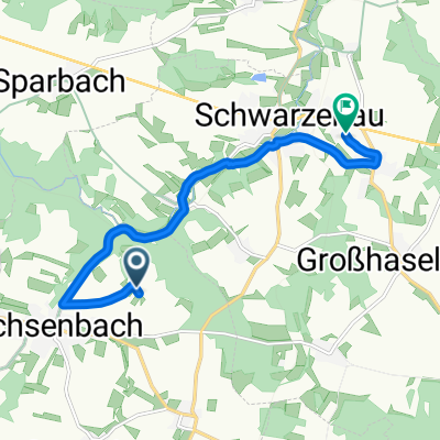
A cycling route starting in Echsenbach, Lower Austria, Austria.
Overview
About this route
Return trip from Gerweis in Waldviertel to Vienna, Floridsdorfer Bridge. Variant via Tulln, with a final climb to the Doppler hut and then out through the Weidlingbach Valley.
- -:--
- Duration
- 142.9 km
- Distance
- 584 m
- Ascent
- 1,001 m
- Descent
- ---
- Avg. speed
- ---
- Max. altitude
Route quality
Waytypes & surfaces along the route
Waytypes
Road
24.3 km
(17 %)
Quiet road
10 km
(7 %)
Surfaces
Paved
88.6 km
(62 %)
Asphalt
88.6 km
(62 %)
Undefined
54.3 km
(38 %)
Continue with Bikemap
Use, edit, or download this cycling route
You would like to ride Gerweis (Waldviertel) - Wien or customize it for your own trip? Here is what you can do with this Bikemap route:
Free features
- Save this route as favorite or in collections
- Copy & plan your own version of this route
- Split it into stages to create a multi-day tour
- Sync your route with Garmin or Wahoo
Premium features
Free trial for 3 days, or one-time payment. More about Bikemap Premium.
- Navigate this route on iOS & Android
- Export a GPX / KML file of this route
- Create your custom printout (try it for free)
- Download this route for offline navigation
Discover more Premium features.
Get Bikemap PremiumFrom our community
Other popular routes starting in Echsenbach
 Steingraben 20, Echsenbach nach L8073 23
- Distance
- 36.3 km
- Ascent
- 473 m
- Descent
- 538 m
- Location
- Echsenbach, Lower Austria, Austria
 Knödel Var KTM
- Distance
- 31.6 km
- Ascent
- 232 m
- Descent
- 229 m
- Location
- Echsenbach, Lower Austria, Austria
 Echsenbach Katastralgemeindenrunde
- Distance
- 20.3 km
- Ascent
- 180 m
- Descent
- 179 m
- Location
- Echsenbach, Lower Austria, Austria
 2022 - 60km Fittes-Waldviertel
- Distance
- 58.3 km
- Ascent
- 443 m
- Descent
- 436 m
- Location
- Echsenbach, Lower Austria, Austria
 Schwarzenau
- Distance
- 55.9 km
- Ascent
- 587 m
- Descent
- 744 m
- Location
- Echsenbach, Lower Austria, Austria
 Echsenbach nach Hausbach
- Distance
- 8.1 km
- Ascent
- 39 m
- Descent
- 127 m
- Location
- Echsenbach, Lower Austria, Austria
 Nordhangstraße 40, Echsenbach nach Nordhangstraße 39, Echsenbach
- Distance
- 23.2 km
- Ascent
- 635 m
- Descent
- 691 m
- Location
- Echsenbach, Lower Austria, Austria
 Knödel-Tour
- Distance
- 40.4 km
- Ascent
- 309 m
- Descent
- 306 m
- Location
- Echsenbach, Lower Austria, Austria
Open it in the app