

Route van D109, Ayzieu
A cycling route starting in Cazaubon, Occitanie, France.
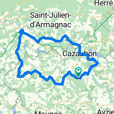
Overview
About this route
- 2 h 30 min
- Duration
- 31.6 km
- Distance
- 290 m
- Ascent
- 259 m
- Descent
- 12.7 km/h
- Avg. speed
- ---
- Max. altitude
Route quality
Waytypes & surfaces along the route
Waytypes
Quiet road
11.7 km
(37 %)
Road
11.3 km
(36 %)
Surfaces
Paved
3.7 km
(12 %)
Unpaved
0.7 km
(2 %)
Paved (undefined)
2 km
(6 %)
Asphalt
1.7 km
(5 %)
Continue with Bikemap
Use, edit, or download this cycling route
You would like to ride Route van D109, Ayzieu or customize it for your own trip? Here is what you can do with this Bikemap route:
Free features
- Save this route as favorite or in collections
- Copy & plan your own version of this route
- Sync your route with Garmin or Wahoo
Premium features
Free trial for 3 days, or one-time payment. More about Bikemap Premium.
- Navigate this route on iOS & Android
- Export a GPX / KML file of this route
- Create your custom printout (try it for free)
- Download this route for offline navigation
Discover more Premium features.
Get Bikemap PremiumFrom our community
Other popular routes starting in Cazaubon
 Eug-laberdolive
- Distance
- 43.8 km
- Ascent
- 288 m
- Descent
- 320 m
- Location
- Cazaubon, Occitanie, France
 2015 Ride Day 35 - Labastide d'Armagnac to Le Passage-d'Agen
- Distance
- 85.5 km
- Ascent
- 507 m
- Descent
- 532 m
- Location
- Cazaubon, Occitanie, France
 RANDONNEE ABC DE LAREE
- Distance
- 50 km
- Ascent
- 401 m
- Descent
- 433 m
- Location
- Cazaubon, Occitanie, France
 ESTOURES/LAREE/ESCOUBES/CAZAUBON/MAUVEZIN D'A/LABASTIDE D'A/LANNEMAGNAN/MAULEON D'A/MONCLAR/LAREE (ESTOURES)
- Distance
- 45 km
- Ascent
- 233 m
- Descent
- 231 m
- Location
- Cazaubon, Occitanie, France
 Itinéraire reposant en Villeneuve-de-Marsan
- Distance
- 14.9 km
- Ascent
- 132 m
- Descent
- 144 m
- Location
- Cazaubon, Occitanie, France
 Lusolle: SOURCES DE MONCAUT
- Distance
- 83.6 km
- Ascent
- 217 m
- Descent
- 217 m
- Location
- Cazaubon, Occitanie, France
 SENNE naar LABASTIDE via Soubére/Lannemagnan terug via Betbezer en Mauvezin
- Distance
- 41 km
- Ascent
- 241 m
- Descent
- 242 m
- Location
- Cazaubon, Occitanie, France
 FIETSTOCHT LIAS PANJAS MONGUILHEM MAULEON MONCLAR
- Distance
- 33.9 km
- Ascent
- 312 m
- Descent
- 311 m
- Location
- Cazaubon, Occitanie, France
Open it in the app