

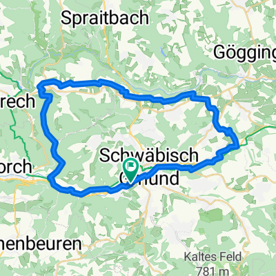
Von Schwäbisch Gmünd über den Rosenstein ins Wental
A cycling route starting in Schwäbisch Gmünd, Baden-Wurttemberg, Germany.
Overview
About this route
1
Aussicht geniessen vom Rosenstein und Felsen gucken im Wental
Anstieg zum Rosenstein, danach weitestgehend flach
Hauptsächlich Wald- und Feldwege
- -:--
- Duration
- 73.1 km
- Distance
- 846 m
- Ascent
- 846 m
- Descent
- ---
- Avg. speed
- ---
- Max. altitude
cykerstin
created this 15 years ago
Continue with Bikemap
Use, edit, or download this cycling route
You would like to ride Von Schwäbisch Gmünd über den Rosenstein ins Wental or customize it for your own trip? Here is what you can do with this Bikemap route:
Free features
- Save this route as favorite or in collections
- Copy & plan your own version of this route
- Sync your route with Garmin or Wahoo
Premium features
Free trial for 3 days, or one-time payment. More about Bikemap Premium.
- Navigate this route on iOS & Android
- Export a GPX / KML file of this route
- Create your custom printout (try it for free)
- Download this route for offline navigation
Discover more Premium features.
Get Bikemap PremiumFrom our community
Other popular routes starting in Schwäbisch Gmünd
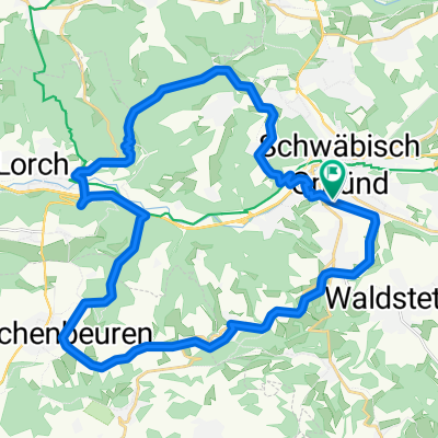
- Gmünd - Zimmern - Lindach - Alfdorf - Gmünd2
- 36.8 km
- 298 m
- 298 m
- Schwäbisch Gmünd, Baden-Wurttemberg, Germany
- Schindelackerweg, Schwäbisch Gmünd nach Mittelbachstraße, Aalen0
- 26.1 km
- 364 m
- 263 m
- Schwäbisch Gmünd, Baden-Wurttemberg, Germany
- Gmünd-Wäschenbeuren-Lorch-Haselbachtal-Himmel2
- 34.4 km
- 423 m
- 428 m
- Schwäbisch Gmünd, Baden-Wurttemberg, Germany
- Gmünd - Dehner - Aasrücken - Wäscherschloss - Gmünd2
- 30.3 km
- 480 m
- 480 m
- Schwäbisch Gmünd, Baden-Wurttemberg, Germany


Open it in the app