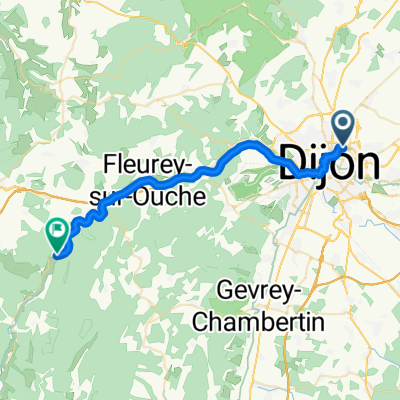
BOURGOGNE Côte d'or - Randonnée des sources (21)
A cycling route starting in Saint-Apollinaire, Bourgogne-Franche-Comté, France.
Overview
About this route
200 km route shortened (last loop via Brèze not done due to too much car traffic in my opinion).
- -:--
- Duration
- 157.8 km
- Distance
- 1,193 m
- Ascent
- 1,194 m
- Descent
- ---
- Avg. speed
- ---
- Max. altitude
Route quality
Waytypes & surfaces along the route
Waytypes
Road
55.2 km
(35 %)
Quiet road
30 km
(19 %)
Surfaces
Paved
44.2 km
(28 %)
Asphalt
44.2 km
(28 %)
Undefined
113.6 km
(72 %)
Continue with Bikemap
Use, edit, or download this cycling route
You would like to ride BOURGOGNE Côte d'or - Randonnée des sources (21) or customize it for your own trip? Here is what you can do with this Bikemap route:
Free features
- Save this route as favorite or in collections
- Copy & plan your own version of this route
- Split it into stages to create a multi-day tour
- Sync your route with Garmin or Wahoo
Premium features
Free trial for 3 days, or one-time payment. More about Bikemap Premium.
- Navigate this route on iOS & Android
- Export a GPX / KML file of this route
- Create your custom printout (try it for free)
- Download this route for offline navigation
Discover more Premium features.
Get Bikemap PremiumFrom our community
Other popular routes starting in Saint-Apollinaire
 • Dijon_links zum Kanal 19 km, abends Theater
- Distance
- 19.9 km
- Ascent
- 96 m
- Descent
- 99 m
- Location
- Saint-Apollinaire, Bourgogne-Franche-Comté, France
 France2023 E5
- Distance
- 85.8 km
- Ascent
- 435 m
- Descent
- 494 m
- Location
- Saint-Apollinaire, Bourgogne-Franche-Comté, France
 Dijon_links zum Kanal 50 km
- Distance
- 50.8 km
- Ascent
- 295 m
- Descent
- 291 m
- Location
- Saint-Apollinaire, Bourgogne-Franche-Comté, France
 Dijon - Ahuy - Messine et vantoux - Asnières les Dijon - Dijon
- Distance
- 22.2 km
- Ascent
- 106 m
- Descent
- 108 m
- Location
- Saint-Apollinaire, Bourgogne-Franche-Comté, France
 Dijon Turcey Bussy Pasques Dijon
- Distance
- 100.2 km
- Ascent
- 750 m
- Descent
- 750 m
- Location
- Saint-Apollinaire, Bourgogne-Franche-Comté, France
 From Dijon to Gissey-sur-Ouche
- Distance
- 30.9 km
- Ascent
- 171 m
- Descent
- 120 m
- Location
- Saint-Apollinaire, Bourgogne-Franche-Comté, France
 2009 Euro Tour -- Ride Day 14 — 7 July 2009 — 21850 St-Apollinaire (Dijon) -- Circle
- Distance
- 60.6 km
- Ascent
- 461 m
- Descent
- 460 m
- Location
- Saint-Apollinaire, Bourgogne-Franche-Comté, France
 DIJON - CHAMPS /Marne
- Distance
- 447 km
- Ascent
- 367 m
- Descent
- 572 m
- Location
- Saint-Apollinaire, Bourgogne-Franche-Comté, France
Open it in the app


