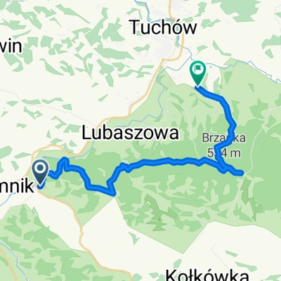
KTA W Pog贸rza
A cycling route starting in Gromnik, Lesser Poland Voivodeship, Poland.
Overview
About this route
Na drodze, jad膮c przez Jod艂贸wk臋 Tuchowsk膮, Rzepiennik, Ci臋偶kowice, Kipszn膮 czekaj膮 na Ciebie w sumie... 4 pag贸ry. Na (nie)szcze艣cie sa to ca艂kiem strome g贸rki, ale nic to, bo szybko si臋 z nich zje偶d偶a. Szybko, z 艂agodnymi zakr臋tami i dobr膮 szos膮.<br /><br />Mniej do艣wiadczeni rowerzy艣ci (co nie przejad膮 70km) niech dadz膮 sobie spok贸j, zwyczajnie wysi膮d膮 na drugiej g贸rce...<br /><br />A innych zapraszam do jazdy.<br /><br />TYP: g贸rskie szosy
TRUDNO艢膯 7/10<br />WIDOKI 7/10<br />MIODNO艢膯 7/10<br />SZUTER/SZOSA [%] 0/100<br />G脫RSKO/R脫WNO [%] 70/30
- -:--
- Duration
- 41.9 km
- Distance
- 600 m
- Ascent
- 604 m
- Descent
- ---
- Avg. speed
- ---
- Avg. speed
Route quality
Waytypes & surfaces along the route
Waytypes
Quiet road
19.2 km
(46 %)
Road
13 km
(31 %)
Surfaces
Paved
35.6 km
(85 %)
Unpaved
0.9 km
(2 %)
Asphalt
35 km
(84 %)
Unpaved (undefined)
0.9 km
(2 %)
Continue with Bikemap
Use, edit, or download this cycling route
You would like to ride KTA W Pog贸rza or customize it for your own trip? Here is what you can do with this Bikemap route:
Free features
- Save this route as favorite or in collections
- Copy & plan your own version of this route
- Sync your route with Garmin or Wahoo
Premium features
Free trial for 3 days, or one-time payment. More about Bikemap Premium.
- Navigate this route on iOS & Android
- Export a GPX / KML file of this route
- Create your custom printout (try it for free)
- Download this route for offline navigation
Discover more Premium features.
Get Bikemap PremiumFrom our community
Other popular routes starting in Gromnik
- Gromnik-Zag贸rze-Zakliczyn-Gromnik 37 km
- Distance
- 36.7 km
- Ascent
- 375 m
- Descent
- 378 m
- Location
- Gromnik, Lesser Poland Voivodeship, Poland
- KTA W Pog贸rza
- Distance
- 41.9 km
- Ascent
- 600 m
- Descent
- 604 m
- Location
- Gromnik, Lesser Poland Voivodeship, Poland
- Lipnica Murowana
- Distance
- 109.7 km
- Ascent
- 742 m
- Descent
- 741 m
- Location
- Gromnik, Lesser Poland Voivodeship, Poland
- 200 km
- Distance
- 202.8 km
- Ascent
- 1,479 m
- Descent
- 1,478 m
- Location
- Gromnik, Lesser Poland Voivodeship, Poland
- 20160521_132941.gpx
- Distance
- 36.5 km
- Ascent
- 391 m
- Descent
- 391 m
- Location
- Gromnik, Lesser Poland Voivodeship, Poland
- wewqeqw
- Distance
- 51.4 km
- Ascent
- 294 m
- Descent
- 308 m
- Location
- Gromnik, Lesser Poland Voivodeship, Poland
- Brzanka Biegowo Maraton G贸rski
- Distance
- 43 km
- Ascent
- 886 m
- Descent
- 845 m
- Location
- Gromnik, Lesser Poland Voivodeship, Poland
- Kacowa
- Distance
- 21.5 km
- Ascent
- 390 m
- Descent
- 394 m
- Location
- Gromnik, Lesser Poland Voivodeship, Poland
Open it in the app