

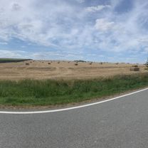
Thayarunde-Süd-Radweg
A cycling route starting in Göpfritz an der Wild, Lower Austria, Austria.
Overview
About this route
- 2 h 40 min
- Duration
- 41.1 km
- Distance
- 432 m
- Ascent
- 432 m
- Descent
- 15.4 km/h
- Avg. speed
- 649 m
- Max. altitude

Route quality
Waytypes & surfaces along the route
Waytypes
Cycleway
9.5 km
(23 %)
Road
7.8 km
(19 %)
Surfaces
Paved
33.7 km
(82 %)
Asphalt
32.9 km
(80 %)
Paved (undefined)
0.8 km
(2 %)
Undefined
7.4 km
(18 %)
Continue with Bikemap
Use, edit, or download this cycling route
You would like to ride Thayarunde-Süd-Radweg or customize it for your own trip? Here is what you can do with this Bikemap route:
Free features
- Save this route as favorite or in collections
- Copy & plan your own version of this route
- Sync your route with Garmin or Wahoo
Premium features
Free trial for 3 days, or one-time payment. More about Bikemap Premium.
- Navigate this route on iOS & Android
- Export a GPX / KML file of this route
- Create your custom printout (try it for free)
- Download this route for offline navigation
Discover more Premium features.
Get Bikemap PremiumFrom our community
Other popular routes starting in Göpfritz an der Wild
 48.735, 15.384 nach 48.998, 15.356
- Distance
- 55 km
- Ascent
- 563 m
- Descent
- 620 m
- Location
- Göpfritz an der Wild, Lower Austria, Austria
 Knödelland-Radweg ab Göpfritz an der Wild
- Distance
- 43.3 km
- Ascent
- 457 m
- Descent
- 506 m
- Location
- Göpfritz an der Wild, Lower Austria, Austria
 Thayarunde
- Distance
- 97.2 km
- Ascent
- 575 m
- Descent
- 575 m
- Location
- Göpfritz an der Wild, Lower Austria, Austria
 göpfritz - raabs - karlstein - dobersberg - waidhofen - göpfritz
- Distance
- 72.1 km
- Ascent
- 457 m
- Descent
- 457 m
- Location
- Göpfritz an der Wild, Lower Austria, Austria
 durch den Tüpl
- Distance
- 47 km
- Ascent
- 454 m
- Descent
- 454 m
- Location
- Göpfritz an der Wild, Lower Austria, Austria
 kleine Familienrunde zum Heurigen
- Distance
- 26.5 km
- Ascent
- 211 m
- Descent
- 199 m
- Location
- Göpfritz an der Wild, Lower Austria, Austria
 KnödelLand Radweg
- Distance
- 43.5 km
- Ascent
- 431 m
- Descent
- 433 m
- Location
- Göpfritz an der Wild, Lower Austria, Austria
 Göpfritz/W. - Raabs/Th.- Slavonice - Waidhofen/Th. - Schwarzenau 2020
- Distance
- 91.8 km
- Ascent
- 394 m
- Descent
- 468 m
- Location
- Göpfritz an der Wild, Lower Austria, Austria
Open it in the app