Aveyron-Tag5--1-0719 Runde angepasst
- 94.2 km
- 995 m
- 1,106 m
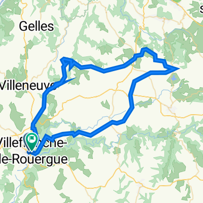
- Villefranche-de-Rouergue, Occitanie, France
A cycling route starting in Villefranche-de-Rouergue, Occitanie, France.
Overview
This was an excellent route on mostly scenic low-traffic country roads.
created this 3 years ago


Route quality
Road
43 km
(81 %)
Quiet road
1.1 km
(2 %)
Paved
30.8 km
(58 %)
Asphalt
30.8 km
(58 %)
Undefined
22.3 km
(42 %)
Continue with Bikemap
You would like to ride Villefranche-de-Rouergue - Circle through St Grat, Castanet, and Monteils or customize it for your own trip? Here is what you can do with this Bikemap route:
Free trial for 3 days, or one-time payment. More about Bikemap Premium.
Discover more Premium features.
Get Bikemap PremiumFrom our community
Open it in the app