

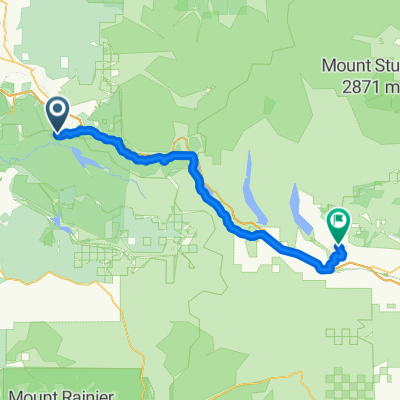
C6MJ+77, Cedar Falls to Iron Horse Trail, North Bend
A cycling route starting in Riverbend, Washington, United States.
Overview
About this route
- 2 h 56 min
- Duration
- 18.4 km
- Distance
- 361 m
- Ascent
- 74 m
- Descent
- 6.3 km/h
- Avg. speed
- 571 m
- Max. altitude

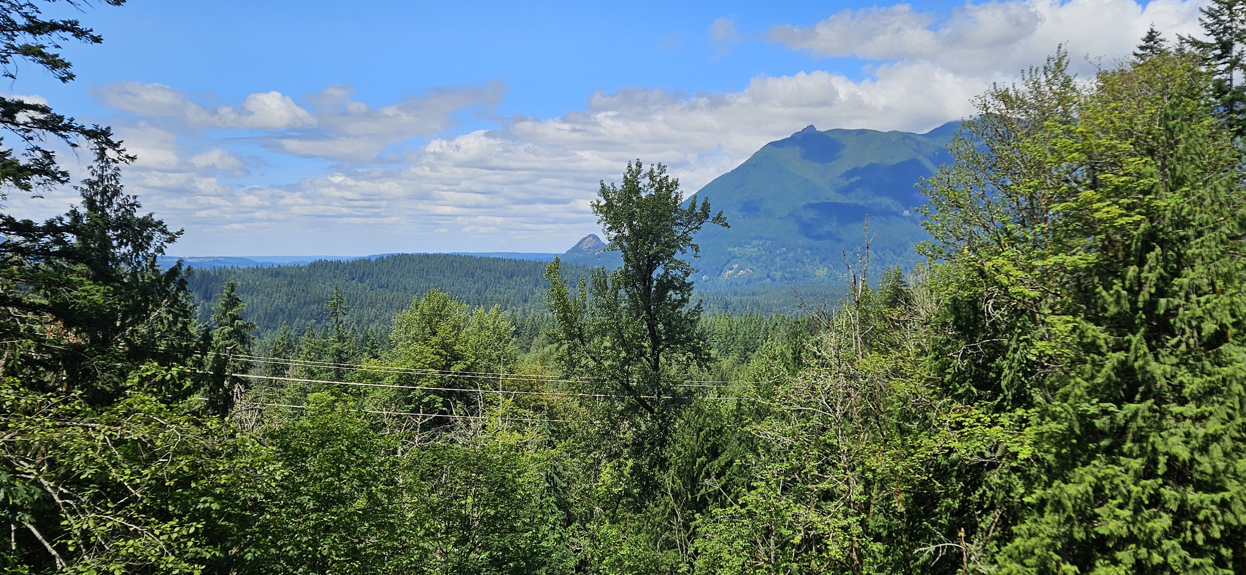
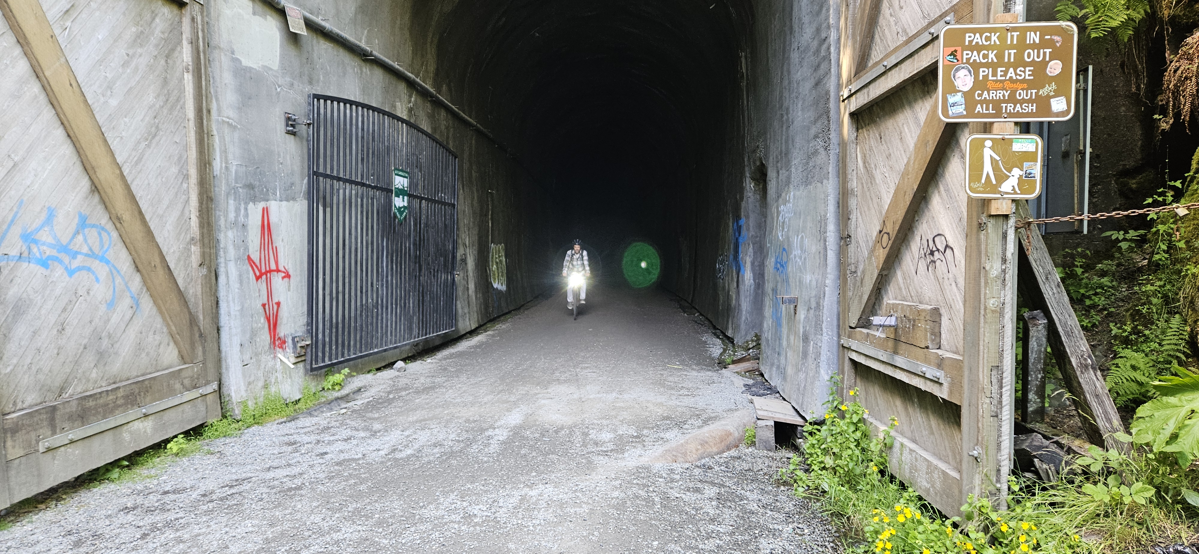
Route photos


Route quality
Waytypes & surfaces along the route
Waytypes
Cycleway
18.2 km
(99 %)
Path
0.2 km
(1 %)
Surfaces
Paved
0.2 km
(1 %)
Unpaved
17.8 km
(97 %)
Gravel
17.8 km
(97 %)
Asphalt
0.2 km
(1 %)
Undefined
0.4 km
(2 %)
Continue with Bikemap
Use, edit, or download this cycling route
You would like to ride C6MJ+77, Cedar Falls to Iron Horse Trail, North Bend or customize it for your own trip? Here is what you can do with this Bikemap route:
Free features
- Save this route as favorite or in collections
- Copy & plan your own version of this route
- Sync your route with Garmin or Wahoo
Premium features
Free trial for 3 days, or one-time payment. More about Bikemap Premium.
- Navigate this route on iOS & Android
- Export a GPX / KML file of this route
- Create your custom printout (try it for free)
- Download this route for offline navigation
Discover more Premium features.
Get Bikemap PremiumFrom our community
Other popular routes starting in Riverbend
 Iron Horse Trail, North Bend to Pike Pl, Seattle
- Distance
- 87.6 km
- Ascent
- 1,425 m
- Descent
- 1,992 m
- Location
- Riverbend, Washington, United States
 noq tunnelSlow ride
- Distance
- 68.8 km
- Ascent
- 594 m
- Descent
- 537 m
- Location
- Riverbend, Washington, United States
 Rattlesnake to Carnation on SVT
- Distance
- 37.1 km
- Ascent
- 392 m
- Descent
- 682 m
- Location
- Riverbend, Washington, United States
 Route from Iron Horse Trail, North Bend
- Distance
- 15.5 km
- Ascent
- 13 m
- Descent
- 251 m
- Location
- Riverbend, Washington, United States
 Rattlesnake to Duvall
- Distance
- 47.2 km
- Ascent
- 279 m
- Descent
- 576 m
- Location
- Riverbend, Washington, United States
 North Bend to Duvall (Snoqualmie Valley Trail)
- Distance
- 50.3 km
- Ascent
- 44 m
- Descent
- 329 m
- Location
- Riverbend, Washington, United States
 Riverbend - Cle Elum
- Distance
- 84.8 km
- Ascent
- 2,067 m
- Descent
- 1,662 m
- Location
- Riverbend, Washington, United States
 Rattlesnake Lake to Hyak with Matt; return
- Distance
- 69.6 km
- Ascent
- 658 m
- Descent
- 599 m
- Location
- Riverbend, Washington, United States
Open it in the app