Von le Puy-en-Velay - Pamblona
A cycling route starting in Le Puy-en-Velay, Auvergne-Rh么ne-Alpes, France.
Overview
About this route
Tour 2004
Period: 16.05- 26.05.04
Participants: G眉nter, Uli and Wolfgang
- -:--
- Duration
- 733.5 km
- Distance
- 8,996 m
- Ascent
- 9,287 m
- Descent
- ---
- Avg. speed
- 1,346 m
- Max. altitude
Route quality
Waytypes & surfaces along the route
Waytypes
Road
73.3 km
(10 %)
Quiet road
73.3 km
(10 %)
Surfaces
Paved
300.7 km
(41 %)
Unpaved
22 km
(3 %)
Asphalt
293.4 km
(40 %)
Paved (undefined)
7.3 km
(1 %)
Continue with Bikemap
Use, edit, or download this cycling route
You would like to ride Von le Puy-en-Velay - Pamblona or customize it for your own trip? Here is what you can do with this Bikemap route:
Free features
- Save this route as favorite or in collections
- Copy & plan your own version of this route
- Split it into stages to create a multi-day tour
- Sync your route with Garmin or Wahoo
Premium features
Free trial for 3 days, or one-time payment. More about Bikemap Premium.
- Navigate this route on iOS & Android
- Export a GPX / KML file of this route
- Create your custom printout (try it for free)
- Download this route for offline navigation
Discover more Premium features.
Get Bikemap PremiumFrom our community
Other popular routes starting in Le Puy-en-Velay
Jakobsweg Etappe 7 - Via Podensis : Le Puy - Decazeville- Distance
- 226 km
- Ascent
- 2,367 m
- Descent
- 2,802 m
- Location
- Le Puy-en-Velay, Auvergne-Rh么ne-Alpes, France
Le Puy en Velay - Capdenac- Distance
- 238.4 km
- Ascent
- 1,827 m
- Descent
- 2,284 m
- Location
- Le Puy-en-Velay, Auvergne-Rh么ne-Alpes, France
2019-18 Le-Puy-en-Velay - Circle to Queyri猫res- Distance
- 52.6 km
- Ascent
- 682 m
- Descent
- 681 m
- Location
- Le Puy-en-Velay, Auvergne-Rh么ne-Alpes, France
voie verte coubon- Distance
- 18.1 km
- Ascent
- 155 m
- Descent
- 149 m
- Location
- Le Puy-en-Velay, Auvergne-Rh么ne-Alpes, France
Jakobsweg Etappe 7 - Via Podensis : Le Puy - Decazeville- Distance
- 226 km
- Ascent
- 2,507 m
- Descent
- 2,943 m
- Location
- Le Puy-en-Velay, Auvergne-Rh么ne-Alpes, France
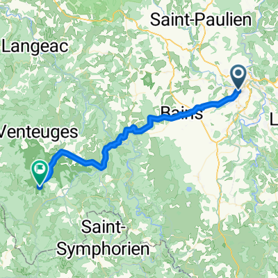
Le Puy en Velay / Saint Vincent- Distance
- 35.9 km
- Ascent
- 220 m
- Descent
- 224 m
- Location
- Le Puy-en-Velay, Auvergne-Rh么ne-Alpes, France
Von le Puy-en-Velay - Pamblona- Distance
- 733.5 km
- Ascent
- 8,996 m
- Descent
- 9,287 m
- Location
- Le Puy-en-Velay, Auvergne-Rh么ne-Alpes, France
Jakobsweg 2018- Distance
- 645.1 km
- Ascent
- 2,206 m
- Descent
- 2,674 m
- Location
- Le Puy-en-Velay, Auvergne-Rh么ne-Alpes, France
Open it in the app

