- 5.2 km
- 34 m
- 87 m
- Rollingwood, Texas, United States
Austin - Circle to Steiner Ranch
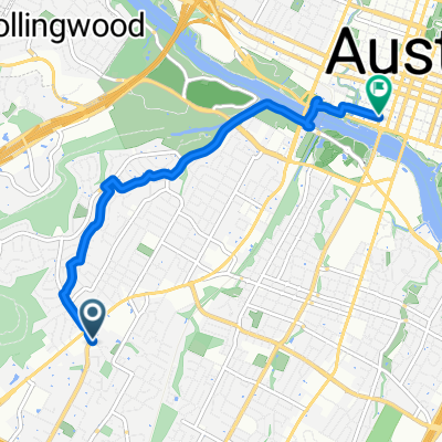
A cycling route starting in Rollingwood, Texas, United States.
Overview
About this route
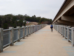
This was a challenging ride with some very steep ups and downs. With one exception, all roads were either residential or on major highways with wide shoulders. The one exception was the steepest part of the climb on Ranch Road 2222 just a little before it hits Ranch Road 620. There was no shoulder. On the uphill side, fortunately, there was a paved drainage area on the side of the highway that I was able to ride on so that I wasn't within the uphill lane. Given the steepness, I was going pretty slowly.
- 3 h 33 min
- Duration
- 56.1 km
- Distance
- 757 m
- Ascent
- 758 m
- Descent
- 15.8 km/h
- Avg. speed
- 339 m
- Max. altitude
created this 9 months ago
Route photos
Route quality
Waytypes & surfaces along the route
Waytypes
Road
24.7 km
(44 %)
Quiet road
5 km
(9 %)
Surfaces
Paved
48.8 km
(87 %)
Asphalt
46.6 km
(83 %)
Concrete
2.2 km
(4 %)
Undefined
7.3 km
(13 %)
Continue with Bikemap
Use, edit, or download this cycling route
You would like to ride Austin - Circle to Steiner Ranch or customize it for your own trip? Here is what you can do with this Bikemap route:
Free features
- Save this route as favorite or in collections
- Copy & plan your own version of this route
- Sync your route with Garmin or Wahoo
Premium features
Free trial for 3 days, or one-time payment. More about Bikemap Premium.
- Navigate this route on iOS & Android
- Export a GPX / KML file of this route
- Create your custom printout (try it for free)
- Download this route for offline navigation
Discover more Premium features.
Get Bikemap PremiumFrom our community
Other popular routes starting in Rollingwood
- Zilker Volleyball Courts
- Lightsey Rd, Austin a W Cesar Chavez St, Austin
- 6.6 km
- 33 m
- 94 m
- Rollingwood, Texas, United States
- Twin Falls and Sculpture Falls from East Oak Hill
- 5 km
- 35 m
- 67 m
- Rollingwood, Texas, United States
- Austin - Mopac Cycling Path - Southwest Parkway - William Cannon Dr.
- 16.4 km
- 243 m
- 154 m
- Rollingwood, Texas, United States
- Austin - Circle to Costco North - Research Blvd
- 38.1 km
- 320 m
- 318 m
- Rollingwood, Texas, United States
- Lake Austin
- 18.2 km
- 169 m
- 168 m
- Rollingwood, Texas, United States
- west lake hills
- 34.8 km
- 678 m
- 673 m
- Rollingwood, Texas, United States
- Barton Creek Greenbelt from East Oak Hill
- 5.5 km
- 104 m
- 95 m
- Rollingwood, Texas, United States
Open it in the app


