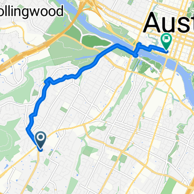
Austin - Circle to Northeast
A cycling route starting in Rollingwood, Texas, United States of America.
Overview
About this route
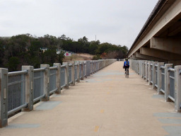
This was a ride primarily through neighborhoods and downtown. Virtually all of the ride was on neighborhood roads with no traffic or arterial roads with cycling lanes.
- 2 h 28 min
- Duration
- 36.4 km
- Distance
- 270 m
- Ascent
- 276 m
- Descent
- 14.7 km/h
- Avg. speed
- 240 m
- Avg. speed
Route photos
Route quality
Waytypes & surfaces along the route
Waytypes
Road
13.2 km
(36 %)
Quiet road
8.1 km
(22 %)
Surfaces
Paved
25.7 km
(71 %)
Unpaved
0.3 km
(<1 %)
Asphalt
19.4 km
(53 %)
Concrete
3.4 km
(9 %)
Continue with Bikemap
Use, edit, or download this cycling route
You would like to ride Austin - Circle to Northeast or customize it for your own trip? Here is what you can do with this Bikemap route:
Free features
- Save this route as favorite or in collections
- Copy & plan your own version of this route
- Sync your route with Garmin or Wahoo
Premium features
Free trial for 3 days, or one-time payment. More about Bikemap Premium.
- Navigate this route on iOS & Android
- Export a GPX / KML file of this route
- Create your custom printout (try it for free)
- Download this route for offline navigation
Discover more Premium features.
Get Bikemap PremiumFrom our community
Other popular routes starting in Rollingwood
- Austin - Circle Southeast to Richard Moya Park
- Distance
- 47.2 km
- Ascent
- 288 m
- Descent
- 288 m
- Location
- Rollingwood, Texas, United States of America
- Austin to Giddings
- Distance
- 113.7 km
- Ascent
- 492 m
- Descent
- 529 m
- Location
- Rollingwood, Texas, United States of America
- Austin - Circle to MT Supermarket and Walnut Creek
- Distance
- 49.2 km
- Ascent
- 414 m
- Descent
- 413 m
- Location
- Rollingwood, Texas, United States of America
- Austin - Circle to Bee Cave
- Distance
- 44.6 km
- Ascent
- 562 m
- Descent
- 564 m
- Location
- Rollingwood, Texas, United States of America
- Austin - Circle to Northwest
- Distance
- 33.8 km
- Ascent
- 514 m
- Descent
- 506 m
- Location
- Rollingwood, Texas, United States of America
- Austin - Circle to Northeast
- Distance
- 36.4 km
- Ascent
- 270 m
- Descent
- 276 m
- Location
- Rollingwood, Texas, United States of America
- Austin - Random Riding in Neighborhood North of MUNY Golf Course
- Distance
- 18.7 km
- Ascent
- 290 m
- Descent
- 290 m
- Location
- Rollingwood, Texas, United States of America
- Austin - Circle thru Lost Creek Blvd to Barton Creek and Costco
- Distance
- 41.4 km
- Ascent
- 572 m
- Descent
- 572 m
- Location
- Rollingwood, Texas, United States of America