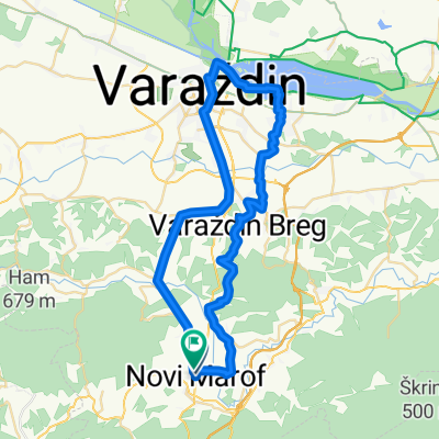
2009 SUMMER TRIP KRK1
A cycling route starting in Remetinec, Varaždin County, Croatia.
Overview
About this route
10 days vication trip from Madžarevo (Novi Marof) to Rasopasno (Island krk).
Trip duration 13h02min, avarage speed 20.13Km/h.Hostel in Vrbovsko.
TOTAL 595KM
CUBE REACTION K18
- -:--
- Duration
- 278.6 km
- Distance
- 2,524 m
- Ascent
- 2,204 m
- Descent
- ---
- Avg. speed
- 887 m
- Max. altitude
Route quality
Waytypes & surfaces along the route
Waytypes
Busy road
184.9 km
(66 %)
Quiet road
20.9 km
(7 %)
Surfaces
Paved
239.5 km
(86 %)
Unpaved
1.6 km
(<1 %)
Asphalt
238.6 km
(86 %)
Unpaved (undefined)
1.2 km
(<1 %)
Route highlights
Points of interest along the route
Accommodation after 166.9 km
Photo after 202.3 km
Prijevoj
Continue with Bikemap
Use, edit, or download this cycling route
You would like to ride 2009 SUMMER TRIP KRK1 or customize it for your own trip? Here is what you can do with this Bikemap route:
Free features
- Save this route as favorite or in collections
- Copy & plan your own version of this route
- Split it into stages to create a multi-day tour
- Sync your route with Garmin or Wahoo
Premium features
Free trial for 3 days, or one-time payment. More about Bikemap Premium.
- Navigate this route on iOS & Android
- Export a GPX / KML file of this route
- Create your custom printout (try it for free)
- Download this route for offline navigation
Discover more Premium features.
Get Bikemap PremiumFrom our community
Other popular routes starting in Remetinec
- 18. Šic na bic - 40km
- Distance
- 116.8 km
- Ascent
- 973 m
- Descent
- 1,064 m
- Location
- Remetinec, Varaždin County, Croatia
- 2010 SUMMER TRIP KRK2
- Distance
- 631.7 km
- Ascent
- 2,388 m
- Descent
- 2,393 m
- Location
- Remetinec, Varaždin County, Croatia
- Šic na bic, 2014.
- Distance
- 54.9 km
- Ascent
- 268 m
- Descent
- 265 m
- Location
- Remetinec, Varaždin County, Croatia
- 2011-Mađarski gulaš - Balaton
- Distance
- 466 km
- Ascent
- 479 m
- Descent
- 483 m
- Location
- Remetinec, Varaždin County, Croatia
- Pušta Bela (mit kurzem Fußmarsch) , Belski Dol und oberes Bednjatal
- Distance
- 26.7 km
- Ascent
- 371 m
- Descent
- 427 m
- Location
- Remetinec, Varaždin County, Croatia
- Šic na Bic 2006. - Tour de Grah
- Distance
- 35.3 km
- Ascent
- 461 m
- Descent
- 461 m
- Location
- Remetinec, Varaždin County, Croatia
- Šic na Bic 2010 - nije bitna ruta zajedno smo peti puta
- Distance
- 34.6 km
- Ascent
- 318 m
- Descent
- 320 m
- Location
- Remetinec, Varaždin County, Croatia
- Šic na Bic 2015. - Biciklom preko brda, da bi guza bila tvrda!
- Distance
- 49 km
- Ascent
- 569 m
- Descent
- 570 m
- Location
- Remetinec, Varaždin County, Croatia
Open it in the app