

20170524_093237.gpx
A cycling route starting in Höchst im Odenwald, Hesse, Germany.
Overview
About this route
TAHUNA track
- -:--
- Duration
- 73.5 km
- Distance
- 571 m
- Ascent
- 388 m
- Descent
- ---
- Avg. speed
- ---
- Max. altitude

Route quality
Waytypes & surfaces along the route
Waytypes
Quiet road
19.1 km
(26 %)
Track
17.6 km
(24 %)
Surfaces
Paved
56.6 km
(77 %)
Unpaved
4.4 km
(6 %)
Asphalt
55.1 km
(75 %)
Gravel
2.9 km
(4 %)
Route highlights
Points of interest along the route
Point of interest after 6.2 km
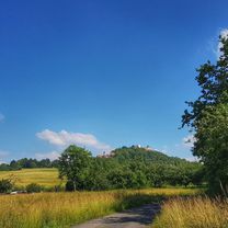
BURG BREUBERG
Point of interest after 30.1 km
49°45.617' 9°10.748'
Point of interest after 46.1 km
49°44.221' 9°16.569'
Continue with Bikemap
Use, edit, or download this cycling route
You would like to ride 20170524_093237.gpx or customize it for your own trip? Here is what you can do with this Bikemap route:
Free features
- Save this route as favorite or in collections
- Copy & plan your own version of this route
- Sync your route with Garmin or Wahoo
Premium features
Free trial for 3 days, or one-time payment. More about Bikemap Premium.
- Navigate this route on iOS & Android
- Export a GPX / KML file of this route
- Create your custom printout (try it for free)
- Download this route for offline navigation
Discover more Premium features.
Get Bikemap PremiumFrom our community
Other popular routes starting in Höchst im Odenwald
 Lengfeld und der Otzberg
- Distance
- 25.5 km
- Ascent
- 358 m
- Descent
- 376 m
- Location
- Höchst im Odenwald, Hesse, Germany
 Rimhorn-Lützelbach-Hainstadt Runde
- Distance
- 30.4 km
- Ascent
- 617 m
- Descent
- 620 m
- Location
- Höchst im Odenwald, Hesse, Germany
 3 Brunnen Runde
- Distance
- 31.2 km
- Ascent
- 441 m
- Descent
- 437 m
- Location
- Höchst im Odenwald, Hesse, Germany
 über die Hohe Straße
- Distance
- 25.3 km
- Ascent
- 377 m
- Descent
- 373 m
- Location
- Höchst im Odenwald, Hesse, Germany
 Frankfurter Straße-Binselberg-Wendelinuskapelle-Umstadt
- Distance
- 35.7 km
- Ascent
- 479 m
- Descent
- 477 m
- Location
- Höchst im Odenwald, Hesse, Germany
 Wald-Amorbach Runde
- Distance
- 21.8 km
- Ascent
- 579 m
- Descent
- 580 m
- Location
- Höchst im Odenwald, Hesse, Germany
 Zum Brauereihoffest Ederbräu
- Distance
- 39 km
- Ascent
- 480 m
- Descent
- 479 m
- Location
- Höchst im Odenwald, Hesse, Germany
 Zur Konfirmanden Buche und in den Kellergrund
- Distance
- 25.4 km
- Ascent
- 789 m
- Descent
- 785 m
- Location
- Höchst im Odenwald, Hesse, Germany
Open it in the app