- 28.5 km
- 427 m
- 424 m
- Höchst im Odenwald, Hesse, Germany
über den Wartturm, Kahl am Main, Aschaffenburg und wieder Heim
A cycling route starting in Höchst im Odenwald, Hesse, Germany.
Overview
About this route
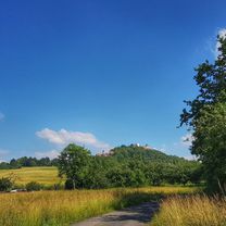
Today we're starting quite early to have lunch at the tavern by the lake. Everything went well. We got a nice shady spot. From here, back to the Main ferry at Seligenstadt and along the Main cycle path to Aschaffenburg. After a short visit to the Main beer garden, we head over to Schönbusch. Here’s our last snack before heading back to the Odenwald. #noebike
- -:--
- Duration
- 91.8 km
- Distance
- 495 m
- Ascent
- 494 m
- Descent
- ---
- Avg. speed
- ---
- Max. altitude
created this 7 years ago
Route photos
Route quality
Waytypes & surfaces along the route
Waytypes
Track
45 km
(49 %)
Path
25.7 km
(28 %)
Surfaces
Paved
45 km
(49 %)
Unpaved
36.7 km
(40 %)
Asphalt
42.2 km
(46 %)
Gravel
24.8 km
(27 %)
Continue with Bikemap
Use, edit, or download this cycling route
You would like to ride über den Wartturm, Kahl am Main, Aschaffenburg und wieder Heim or customize it for your own trip? Here is what you can do with this Bikemap route:
Free features
- Save this route as favorite or in collections
- Copy & plan your own version of this route
- Split it into stages to create a multi-day tour
- Sync your route with Garmin or Wahoo
Premium features
Free trial for 3 days, or one-time payment. More about Bikemap Premium.
- Navigate this route on iOS & Android
- Export a GPX / KML file of this route
- Create your custom printout (try it for free)
- Download this route for offline navigation
Discover more Premium features.
Get Bikemap PremiumFrom our community
Other popular routes starting in Höchst im Odenwald
- Brunnen und Hütten
- Otzberg und Heubacher Tal
- 27.1 km
- 453 m
- 451 m
- Höchst im Odenwald, Hesse, Germany
- Mit dem Odenwaldferrari nach Michelstadt
- 42.6 km
- 464 m
- 461 m
- Höchst im Odenwald, Hesse, Germany
- Rimhorn+Rai-Breitenbach+Mömlingen+Wald-Amorbach
- 35.4 km
- 516 m
- 514 m
- Höchst im Odenwald, Hesse, Germany
- Zur Konfirmanden Buche und in den Kellergrund
- 25.4 km
- 789 m
- 785 m
- Höchst im Odenwald, Hesse, Germany
- Lengfeld und der Otzberg
- 25.5 km
- 358 m
- 376 m
- Höchst im Odenwald, Hesse, Germany
- Zum Brauereihoffest Ederbräu
- 39 km
- 480 m
- 479 m
- Höchst im Odenwald, Hesse, Germany
- Auf der heutigen Biketour über Wörth und Klingenberg
- 54.7 km
- 146 m
- 145 m
- Höchst im Odenwald, Hesse, Germany
Open it in the app


