Frankfurter Straße-Binselberg-Wendelinuskapelle-Umstadt
A cycling route starting in Höchst im Odenwald, Hesse, Germany.
Overview
About this route
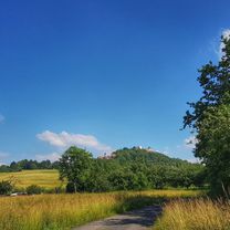
Over not too strenuous climbs, head up onto Frankfurter Straße. Then continue to Rödelshäuschen and over to Binselberg. Now a bit downhill and then a steep climb up to Steingerück. Then over to Stachelberg and to the Wendelinus chapel. Now an easy ride to the beer garden. Then over Heubach and a 20-minute ascent back to Hetschbach. #noebike
- -:--
- Duration
- 35.7 km
- Distance
- 479 m
- Ascent
- 477 m
- Descent
- ---
- Avg. speed
- ---
- Max. altitude
Route photos
Route quality
Waytypes & surfaces along the route
Waytypes
Track
26.8 km
(75 %)
Quiet road
3.2 km
(9 %)
Surfaces
Paved
6.4 km
(18 %)
Unpaved
23.6 km
(66 %)
Gravel
9.6 km
(27 %)
Ground
7.9 km
(22 %)
Continue with Bikemap
Use, edit, or download this cycling route
You would like to ride Frankfurter Straße-Binselberg-Wendelinuskapelle-Umstadt or customize it for your own trip? Here is what you can do with this Bikemap route:
Free features
- Save this route as favorite or in collections
- Copy & plan your own version of this route
- Sync your route with Garmin or Wahoo
Premium features
Free trial for 3 days, or one-time payment. More about Bikemap Premium.
- Navigate this route on iOS & Android
- Export a GPX / KML file of this route
- Create your custom printout (try it for free)
- Download this route for offline navigation
Discover more Premium features.
Get Bikemap PremiumFrom our community
Other popular routes starting in Höchst im Odenwald
- Waldhaus Obernburg
- Distance
- 35.4 km
- Ascent
- 334 m
- Descent
- 332 m
- Location
- Höchst im Odenwald, Hesse, Germany
- 3 Brunnen Runde
- Distance
- 31.2 km
- Ascent
- 441 m
- Descent
- 437 m
- Location
- Höchst im Odenwald, Hesse, Germany
- zum Obernburger Waldhaus
- Distance
- 35.6 km
- Ascent
- 327 m
- Descent
- 324 m
- Location
- Höchst im Odenwald, Hesse, Germany
- Zur Konfirmanden Buche und in den Kellergrund
- Distance
- 25.4 km
- Ascent
- 789 m
- Descent
- 785 m
- Location
- Höchst im Odenwald, Hesse, Germany
- zum Biergarten nach Umscht
- Distance
- 30.8 km
- Ascent
- 470 m
- Descent
- 465 m
- Location
- Höchst im Odenwald, Hesse, Germany
- Wald-Amorbach Runde
- Distance
- 21.8 km
- Ascent
- 579 m
- Descent
- 580 m
- Location
- Höchst im Odenwald, Hesse, Germany
- durch den Mühlgrund
- Distance
- 42.9 km
- Ascent
- 411 m
- Descent
- 408 m
- Location
- Höchst im Odenwald, Hesse, Germany
- Rimhorn-Lützelbach-Hainstadt Runde
- Distance
- 30.4 km
- Ascent
- 617 m
- Descent
- 620 m
- Location
- Höchst im Odenwald, Hesse, Germany
Open it in the app