

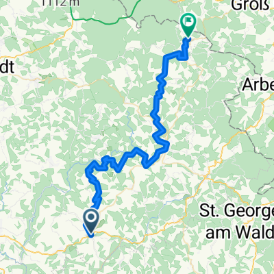
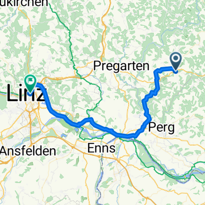
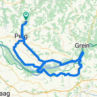
Au - Pasau Donauradweg
A cycling route starting in Perg, Upper Austria, Austria.
Overview
About this route
Along the Danube from Passau on the Donauradweg. The Donauradweg is very well developed here and very pleasant to ride. It goes upstream, mostly against a light headwind.
- -:--
- Duration
- 125.4 km
- Distance
- 363 m
- Ascent
- 297 m
- Descent
- ---
- Avg. speed
- ---
- Max. altitude

Route quality
Waytypes & surfaces along the route
Waytypes
Quiet road
45.2 km
(36 %)
Cycleway
26.3 km
(21 %)
Surfaces
Paved
121.7 km
(97 %)
Unpaved
2.5 km
(2 %)
Asphalt
120.4 km
(96 %)
Ground
2.5 km
(2 %)
Continue with Bikemap
Use, edit, or download this cycling route
You would like to ride Au - Pasau Donauradweg or customize it for your own trip? Here is what you can do with this Bikemap route:
Free features
- Save this route as favorite or in collections
- Copy & plan your own version of this route
- Split it into stages to create a multi-day tour
- Sync your route with Garmin or Wahoo
Premium features
Free trial for 3 days, or one-time payment. More about Bikemap Premium.
- Navigate this route on iOS & Android
- Export a GPX / KML file of this route
- Create your custom printout (try it for free)
- Download this route for offline navigation
Discover more Premium features.
Get Bikemap PremiumFrom our community
Other popular routes starting in Perg
 Hafenstraße, Naarn im Machlande to Hafenstraße, Grein
- Distance
- 32.5 km
- Ascent
- 105 m
- Descent
- 113 m
- Location
- Perg, Upper Austria, Austria
 Tour de Alm Tag 1
- Distance
- 50.1 km
- Ascent
- 1,998 m
- Descent
- 1,571 m
- Location
- Perg, Upper Austria, Austria
 Au - Pasau Donauradweg
- Distance
- 125.4 km
- Ascent
- 363 m
- Descent
- 297 m
- Location
- Perg, Upper Austria, Austria
 Aisttal - Reichenstein Runde
- Distance
- 27.8 km
- Ascent
- 459 m
- Descent
- 458 m
- Location
- Perg, Upper Austria, Austria
 Schwammerlstein Runde
- Distance
- 14.1 km
- Ascent
- 418 m
- Descent
- 419 m
- Location
- Perg, Upper Austria, Austria
 von Bad Zell nach Linz
- Distance
- 50.7 km
- Ascent
- 339 m
- Descent
- 597 m
- Location
- Perg, Upper Austria, Austria
 11. Naarn im Machlande-Engelhartszell
- Distance
- 100.2 km
- Ascent
- 1,243 m
- Descent
- 1,185 m
- Location
- Perg, Upper Austria, Austria
 Allerheiligen-Stift-Ardagger
- Distance
- 79.1 km
- Ascent
- 1,011 m
- Descent
- 1,002 m
- Location
- Perg, Upper Austria, Austria
Open it in the app