zum Obernburger Waldhaus
A cycling route starting in Höchst im Odenwald, Hesse, Germany.
Overview
About this route
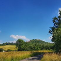
Today is Wednesday, so the Waldhaus is open. An ideal destination on hot days. You can sit nicely in the shade in the beer garden. But also recommended in winter. You can hang out inside then. Very rustic. I don't understand why more mountain bikers don't gather here. #noebike
- -:--
- Duration
- 35.6 km
- Distance
- 327 m
- Ascent
- 324 m
- Descent
- ---
- Avg. speed
- ---
- Max. altitude
Route photos
Route quality
Waytypes & surfaces along the route
Waytypes
Track
19.9 km
(56 %)
Road
5 km
(14 %)
Surfaces
Paved
15.7 km
(44 %)
Unpaved
11.8 km
(33 %)
Asphalt
15 km
(42 %)
Gravel
7.8 km
(22 %)
Continue with Bikemap
Use, edit, or download this cycling route
You would like to ride zum Obernburger Waldhaus or customize it for your own trip? Here is what you can do with this Bikemap route:
Free features
- Save this route as favorite or in collections
- Copy & plan your own version of this route
- Sync your route with Garmin or Wahoo
Premium features
Free trial for 3 days, or one-time payment. More about Bikemap Premium.
- Navigate this route on iOS & Android
- Export a GPX / KML file of this route
- Create your custom printout (try it for free)
- Download this route for offline navigation
Discover more Premium features.
Get Bikemap PremiumFrom our community
Other popular routes starting in Höchst im Odenwald
- Matschetreten Rund um Höchst im #Odenwald
- Distance
- 32.7 km
- Ascent
- 716 m
- Descent
- 719 m
- Location
- Höchst im Odenwald, Hesse, Germany
- über die Hohe Straße
- Distance
- 25.3 km
- Ascent
- 377 m
- Descent
- 373 m
- Location
- Höchst im Odenwald, Hesse, Germany
- 3 Brunnen Runde
- Distance
- 31.2 km
- Ascent
- 441 m
- Descent
- 437 m
- Location
- Höchst im Odenwald, Hesse, Germany
- zum Obernburger Waldhaus
- Distance
- 35.6 km
- Ascent
- 327 m
- Descent
- 324 m
- Location
- Höchst im Odenwald, Hesse, Germany
- Toter Mann - Kimbach - Bad König
- Distance
- 35.6 km
- Ascent
- 608 m
- Descent
- 607 m
- Location
- Höchst im Odenwald, Hesse, Germany
- Waldhaus Obernburg
- Distance
- 35.4 km
- Ascent
- 334 m
- Descent
- 332 m
- Location
- Höchst im Odenwald, Hesse, Germany
- durch den Mühlgrund
- Distance
- 42.9 km
- Ascent
- 411 m
- Descent
- 408 m
- Location
- Höchst im Odenwald, Hesse, Germany
- Zur Konfirmanden Buche und in den Kellergrund
- Distance
- 25.4 km
- Ascent
- 789 m
- Descent
- 785 m
- Location
- Höchst im Odenwald, Hesse, Germany
Open it in the app