Zur Konfirmanden Buche und in den Kellergrund
- 25.4 km
- 789 m
- 785 m
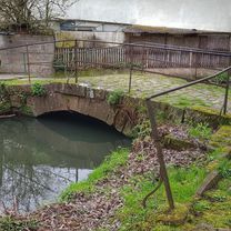
- Höchst im Odenwald, Hesse, Germany
A cycling route starting in Höchst im Odenwald, Hesse, Germany.
Overview
Nur mal eben zum Biergarten, was essen. Dann wieder Heim. #noebike
created this 6 years ago


Route quality
Track
27.5 km
87 %
Access road
1.9 km
6 %
Paved
1.6 km
(5 %)
Unpaved
28.1 km
(89 %)
Gravel
19 km
60 %
Ground
6.3 km
20 %
Continue with Bikemap
You would like to ride zum Biergarten und zurück or customize it for your own trip? Here is what you can do with this Bikemap route:
Free trial for 3 days, or one-time payment. More about Bikemap Premium.
Discover more Premium features.
Get Bikemap PremiumFrom our community
Open it in the app