Zur Konfirmanden Buche und in den Kellergrund
A cycling route starting in Höchst im Odenwald, Hesse, Germany.
Overview
About this route
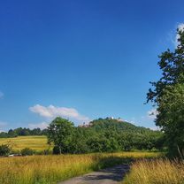
Finally back on the mountain bike. Through Geisrain, I go through the MEDIAN clinic up to the confirmands' beech with its two boundary stones. Now towards Kirschgarten. From here, you have a nice view over to the Spessart. Now a descent to Wald-Amorbach and right back up to Buchwaldsfeld. After a short stretch of Frankfurter Straße, then past Bocksberg down into Kellergrund. Just before Heubach, then up to Tannenberg and back home over Hirsenberg and Schorschberg. #noebike
- -:--
- Duration
- 25.4 km
- Distance
- 789 m
- Ascent
- 785 m
- Descent
- ---
- Avg. speed
- ---
- Max. altitude
Route photos
Route quality
Waytypes & surfaces along the route
Waytypes
Track
22.4 km
(88 %)
Quiet road
1.3 km
(5 %)
Surfaces
Paved
0.3 km
(1 %)
Unpaved
22.6 km
(89 %)
Gravel
8.1 km
(32 %)
Ground
7.6 km
(30 %)
Continue with Bikemap
Use, edit, or download this cycling route
You would like to ride Zur Konfirmanden Buche und in den Kellergrund or customize it for your own trip? Here is what you can do with this Bikemap route:
Free features
- Save this route as favorite or in collections
- Copy & plan your own version of this route
- Sync your route with Garmin or Wahoo
Premium features
Free trial for 3 days, or one-time payment. More about Bikemap Premium.
- Navigate this route on iOS & Android
- Export a GPX / KML file of this route
- Create your custom printout (try it for free)
- Download this route for offline navigation
Discover more Premium features.
Get Bikemap PremiumFrom our community
Other popular routes starting in Höchst im Odenwald
- Frankfurter Straße-Binselberg-Wendelinuskapelle-Umstadt
- Distance
- 35.7 km
- Ascent
- 479 m
- Descent
- 477 m
- Location
- Höchst im Odenwald, Hesse, Germany
- 3 Brunnen Runde
- Distance
- 31.2 km
- Ascent
- 441 m
- Descent
- 437 m
- Location
- Höchst im Odenwald, Hesse, Germany
- Zur Konfirmanden Buche und in den Kellergrund
- Distance
- 25.4 km
- Ascent
- 789 m
- Descent
- 785 m
- Location
- Höchst im Odenwald, Hesse, Germany
- Wald-Amorbach Runde
- Distance
- 21.8 km
- Ascent
- 579 m
- Descent
- 580 m
- Location
- Höchst im Odenwald, Hesse, Germany
- über die Hohe Straße
- Distance
- 25.3 km
- Ascent
- 377 m
- Descent
- 373 m
- Location
- Höchst im Odenwald, Hesse, Germany
- Rimhorn-Lützelbach-Hainstadt Runde
- Distance
- 30.4 km
- Ascent
- 617 m
- Descent
- 620 m
- Location
- Höchst im Odenwald, Hesse, Germany
- Toter Mann - Kimbach - Bad König
- Distance
- 35.6 km
- Ascent
- 608 m
- Descent
- 607 m
- Location
- Höchst im Odenwald, Hesse, Germany
- Matschetreten Rund um Höchst im #Odenwald
- Distance
- 32.7 km
- Ascent
- 716 m
- Descent
- 719 m
- Location
- Höchst im Odenwald, Hesse, Germany
Open it in the app